


1 / 5


Mentioned in This Moment
5/51 reviews | Mountain climbing
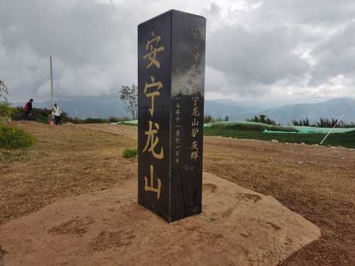
Anning
View
Show More
Popular Trip Moments
Lost in paradise! This hot spring homestay is so healing | Kunming's Spa Hot Spring Valley: A Hot Spring Spa with Incredibly Clean Water | Spend just over ten yuan to enjoy all the attractions | One-Day Trip | Guide to the Pet-Friendly Yulong Bay Scenic Area in Anning | This is a great place to bring your kids! | Escape to Your Dream Vacation at the Wyndham Grand Plaza Royale Anning | Stumble into a Monet Garden! Anning Yuntao Forest Villa | Three days to decode Kunming: a journey of progressive humanistic awakening | Kunming! peaceful! This private hot spring courtyard is a great place to stay! | Go to Golden Mantis River and have a spring dream | Let the hot springs take away your worries and let the warmth heal your soul. | Discover Kunming | How can you know the beauty of early spring without visiting Nanyuan? | Chase the spring breeze and stay at Jinfang | Caoxi Temple: Exquisite | Mati Temple: A Timeless Treasure of Ancient Stone Walls | New Hot Spring Hotel in Anning, Kunming | Around Kunming | Drive 1 hour to reach the forest hot spring secret place | Anning Woyunlu: A Serene Retreat | Anning Caoxi Temple Ancient Yuan Plum | Kunming's "Suzhou Garden" - Nanyuan Garden | Lost in a forest wonderland | Jinfang Forest Hot Spring Hillside Hotel | A real-life version of the Wizard of Oz! This lakeside hotel in Kunming is amazing! | Kunming Hotels with Private Hot Springs | My preferred atmospheric hot spring hotel in Tranquility! | After a year, I visited Kunming Yulongwan Lake View Hotel again | Yunnan, Kunming | SLH Yulongwan Lake View Hotel | "Kunming Yulongwan Lake View Hotel - A Paradise for Family Vacations" | At Kunming Yulongwan!! Such a great stay! I don't want to check out! It's worth crying for | A 30-minute drive from Kunming to a private hot spring under the sunset | A new family-friendly landmark in Kunming, perfect for a family vacation
Popular Travel Types
Recommended Attractions at Popular Destinations
Bangkok attraction near me | Manila attraction near me | Tokyo attraction near me | Taipei attraction near me | Hong Kong attraction near me | Seoul attraction near me | Kuala Lumpur attraction near me | Los Angeles attraction near me | Shanghai attraction near me | New York attraction near me | Shenzhen attraction near me | Osaka attraction near me | Singapore attraction near me | London attraction near me | Guangzhou attraction near me | San Francisco attraction near me | Beijing attraction near me | Macau attraction near me | Bali attraction near me | Jakarta attraction near me | Paris attraction near me | Ho Chi Minh City attraction near me | Istanbul attraction near me | Phuket attraction near me | Chicago attraction near me | Seattle attraction near me | Toronto attraction near me | Orlando attraction near me | Cebu attraction near me | Chiang Mai attraction near me
Popular Attractions
Sky Candle Peak | Shanghai Old Street | Bing'an Ancient Town | Taohuayu | Keukenhof | Wulong Karst Tourism Region | Penida Island | Pavilion of High Mountain and Flowing Water | Red Gate Palace | Tokyo DisneySea | Cuihua Mountain·Qinling Zhongnanshan Unesco Global Geopark | Wolong Bridge | Skyline Rotorua | Juyongguan Great Wall | Maxus Cinemas Vishnu Shivam Mall | Shadaogou | Golden Whip Stream | Our Lady of Fátima Church Macau | Wanquan River | Xpark Aquarium | Hanuman ji Temple | SENDERO LITORAL | Džamija Bukvara | Biblioteca del Mar | arquitectos Park | Matamayo, Ulcumayo - Junín | Wentworth Trail / Mead BaseTrailhead | AIR LIBRARY | Canal de Castilla Park | Dhikkarai Madheshwaran Temple
Popular Restaurants in Anning
Mulansheng Halal Barbecue (Anning Store) | 雲一腿山里人家(安宁店) | 亦如园火锅 | 山里人家(万辉店) | 读书铺酸笋鸡创始店 | 酤居湖景音乐餐吧(安宁店) | 香正府勐海烤鸡 | 一品汤锅(青龙峡店) | 嘉华饼屋(安宁金方店) | 珀玉莲花白米线店 | 花园1号餐厅·云南菜(安宁店) | Jiahuabingwu (jinseguangchang) | 螳川印象花园餐厅 | Laowangmala Chicken (laogonglu) | 开心鱼堂云南草本煳辣鱼(安宁店) | 玉龙湾康谷业主食堂 | YUN NA REN GU BAO XING DIAN | Lierenyuan | 牛大锅涮牛肉(珍泉路店) | 储缘生日蛋糕(安宁店) | XIN FENG DAI GU FENG WEI | 八街双双卷粉(华西店) | Chujunyuan | PANG XIE XIAN SHENG | 德克士(安宁店) | 本大叔·水晶焖锅(伊皇店) | 安宁温泉半岛度假酒店·品味餐厅 | 乡村鸡农家园 | 虔诚猪脚米线(吾悦广场店) | 渡口勐海烤鸡店
Popular Ranked Lists
Popular Luxury Hotels in Dhofar | Popular Luxury Hotels Near Chichibu | Popular Luxury Hotels Near Owani | Top 18 Local Restaurants in Krabi | Top 20 Local Restaurants in Sapporo | Top 19 Local Restaurants in Kobe | Popular Best Things to Do in Shimian | Top 5 Best Things to Do in Gannan | Top 4 Best Things to Do in Jiangmen | Top 10 Local Restaurants in Boracay Island | Top 13 Best Things to Do in Yanbian | Popular Premium Hotels Near Dearborn | Top 10 Luxury Hotels in Red Sea Governorate | Top 4 Best Things to Do in Golmud | Popular Luxury Hotels in Al Ula | Popular Luxury Hotels Near Higashiagatsuma | Popular Best Things to Do in Lincang | Top 20 Local Restaurants in Nanjing | Popular Local Restaurants in Osaka | Popular Local Restaurants in Chongqing | Popular Local Restaurants in Qingdao | Top 6 Best Things to Do in Fenghuang | Top 4 Best Things to Do in Changde | Popular Luxury Hotels Near Century City | Top 12 Local Restaurants in Hakone | Top 16 Best Things to Do in Hulunbuir | Popular Luxury Hotels in Oslo | Popular Luxury Hotels in Astana | Top 5 Best Things to Do in Huludao | Popular Luxury Hotels in Fes-Meknes
Payment Methods
Our Partners
Copyright © 2025 Trip.com Travel Singapore Pte. Ltd. All rights reserved
Site Operator: Trip.com Travel Singapore Pte. Ltd.
Site Operator: Trip.com Travel Singapore Pte. Ltd.