Chinese Unitary YangGong Stone Forest
酉陽紅石林景區Liyang Hongshi Forest Scenic Area is located in Jiangxiwan Village, Mawang Town, Liyang County, Chongqing City, and Jiangxiwan Village, Yigai Town. It has an area of about 2 square kilometers. It is mainly karst landforms, canyon landforms, stratigraphy profiles, paleontological fossils. The color is Yinhong dark purple, and the landscape is in a thousand shapes. Great value for viewing and scientific research.
More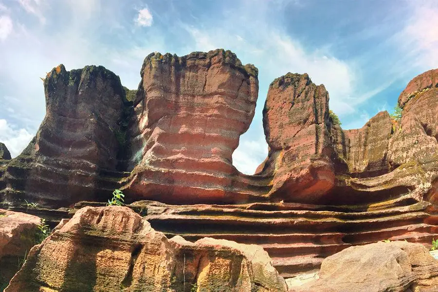
Chinese Unitary YangGong Stone Forest Highlights: Must-See Features and Attractions
The Red Stone Forest is located on a vast red stone ridge between Qiangqiang Village, Mawang Town, Youyang Autonomous County, and Youshuihe Town in the hinterland of Wuling Mountain in southeastern Chongqing. It is a 470-530 million-year-old Cambrian-Ordovician sedimentary carbonate rock. After crustal movement, differentiation, leaching, and dissolution, it formed a red karst karst landform and a cliff canyon. It has a myriad of forms, unique appearance, elegant connotation, and stubborn exterior; it is breathtaking. Step into the Red Stone Forest. It's like walking into a magical and dreamy world! The magical fossils of the Red Stone Forest and the peculiar appearance of the stone forest make the viewer curious and eager to explore the ancient world. The Red Stone Forest Belt is dominated by karst landforms, canyon landforms, and stratigraphic profiles, with a deep red and dark purple color and a variety of landscapes. It has unique tourism appreciation, cultural aesthetics, and geological scientific research experience value. The Stone Forest Belt is located on the right bank of the picturesque Youshui River, starting from Maoertan (a small place name) in the second group of Jiangxiwan Village and ending at Xialazhai (a small place name) in the fourth group of Jiangxiwan Village, with a total length of about 2 kilometers. In the core area of Maoertan, the stone forest covering an area of about 2,000 mu is stacked layer by layer with unique shapes.
Recommendations Near Chinese Unitary YangGong Stone Forest
Chinese Unitary YangGong Stone Forest Reviews: Insider Insights and Visitor Experiences
Some reviews may have been translated by Google Translate- 1
- 2
- 3
- 4
You Might Also Like
Youyang Peach Blossom Spring

Puhua River, Zhuoshui Scenic Area
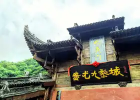
Chiyou Jiuli City
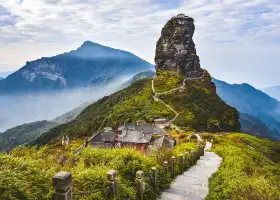
Mount Fanjing
Nearby Attractions
Popular Types of Attractions in Youyang County
Popular Restaurants in Youyang County
Recommended Attractions at Popular Destinations
Popular Ranked Lists
Popular Trip Moments
More Things To Do in Youyang County
Site Operator: Trip.com Travel Singapore Pte. Ltd.
Liyang Hongshi Forest Scenic Area is located in Jiangxiwan Village, Mawang Town, Liyang County, Chongqing City, and Jiangxiwan Village, Yigai Town. It has an area of about 2 square kilometers. It is mainly karst landforms, canyon landforms, stratigraphy profiles, paleontological fossils. The color is Yinhong dark purple, and the landscape is in a thousand shapes. Great value for viewing and scientific research.
The Red Stone Forest Scenic Area is really a spectacle, all of them are red stones. Because there is this scenic spot, this place is also called Red Stone Forest. The photos are very beautiful, and there are many landscapes formed, and some non-hazardous places can climb up to take pictures.
OK, it is not popular, it is OK, it is not popular, it is OK, it is not popular,
The core area of Xiangyang Redstone Forest Geopark is more than 470,000 square meters, and it is the largest, most concentrated and most peculiar red karst stone wheel landscape found in the country and even the world so far. Liyang Hongshilin Geopark is located in the hinterland of Wuling Mountains in southeast Guizhou, and on the vast brown upper ridge between the strengthening village of Mawang Town and the long-term village of Lishuihe Town in Liyang County. Geological experts identified it as the red stone forest. The redstone forest here is a cambrian-ordovician carbonate rock that has been deposited in the cambrian-ordovician for 100 million years, and has formed red karst karst geomorphology and cliff canyons through crustal motion and erosion.
The Liyang Stone Forest Belt is located on the right bank of the picturesque Lishui River, starting from the Maoer Beach (small place name) of the second group of Jiangxi Bay Village, and ending in the Xialazhai (small place name) of the fourth group of Jiangxi Bay Village, which is about 2 kilometers long. Through the field survey of the stone forest belt, the red stone forest belt is mainly karst landform, canyon landform, stratigraphy section, color Yin red dark purple, landscape thousands of states.
The Liyang Stone Forest Belt is located on the right bank of the picturesque Lishui River in Chongqing, starting from the Maoer Beach (small place name) in the second group of Liyang Jiangxiwan Village, and ending in the Xialazhai (small place name) in the fourth group of Jiangxiwan Village, which is about 2 kilometers long. Through the field survey of the stone forest belt, the red stone forest belt is mainly karst landform, canyon landform, stratigraphy section, color Yin red dark purple, landscape thousands of states.