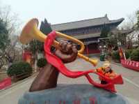
Understanding the geological and geomorphology of Xinjiang, the motherland, and the development history
;
xin jiang sheng tai yu di li yan jiu suo biao ben guan Review
4.5 /529 Reviews


5/5
xin jiang sheng tai yu di li yan jiu suo biao ben guan
Posted: Aug 28, 2019
Like
 4/5ExcellentOriginal Text
In the past, the Junggar Basin was defined as 380,000 square kilometers, and now some areas such as the east of Beita Mountain are not part of the Junggar Basin, with the latest data being 180,000 square kilometers. The Junggar Basin is low in the east and west, and it leans slightly northward, with an average altitude of about 500 meters, the lowest point is Lake Aibi, and the lake is 189 meters above sea level.
Posted: Jun 13, 20220 5/5OutstandingOriginal Text
[View] 👍👍👍👍👍👍👍👍 [Fun] [Fun] 👍👍👍👍👍👍👍👍👍 [Cost-effective] 👍👍👍👍👍
Posted: Sep 28, 20210 5/5OutstandingOriginal Text
Very, very worth going, eye-opening long knowledge, can learn a lot, adults and children are interested, grand recommendation
Posted: Sep 1, 20210 5/5OutstandingOriginal Text
The location of Xinjiang branch of the Chinese Academy of Sciences! The location of the Xinjiang Earthquake Bureau!
Posted: Sep 17, 20210 5/5OutstandingOriginal Text
[View] Good [Fun] Funny [Cost-effective] OK
Posted: Aug 2, 20210- 1
- 2
- 3
- 4
- 6
Recommended Attractions at Popular Destinations
Bangkok attraction near me | Tokyo attraction near me | Manila attraction near me | Hong Kong attraction near me | Taipei attraction near me | Seoul attraction near me | Los Angeles attraction near me | New York attraction near me | Shanghai attraction near me | Kuala Lumpur attraction near me | Shenzhen attraction near me | Osaka attraction near me | Singapore attraction near me | Guangzhou attraction near me | London attraction near me | San Francisco attraction near me | Beijing attraction near me | Macau attraction near me | Bali attraction near me | Paris attraction near me | Ho Chi Minh City attraction near me | Orlando attraction near me | Jakarta attraction near me | Chicago attraction near me | Phuket attraction near me | Toronto attraction near me | Istanbul attraction near me | Dallas attraction near me | Cebu attraction near me | Seattle attraction near me
Popular Attractions
Phillip Island Nature Parks | Parque Centenario | Federation Walk Coastal Reserve | Ko Tao | Pudacuo National Park | New Silk Alley Market (Xiu Shui) | Xiaozhongdian Flower Sea | Plaza Luz | Hop On Hop Off City Tour | Chengdu Du Fu Thatched Cottage Museum | Chongqing Two Rivers Night Tour | Maoming Yushui Ancient Hot Spring Resort | Baisha Ancient Town | Yungu Temple | Jinjiang Paradise | Chiesa Neo-Apostolica Svizzera Lugano-Breganzona | Longtouzhu Scenic Area | Shaheed Smarak | Calvaire d'Oka | Boqiy shahar | Shalbagan jame masjid | Les Amis des Antonins | Bloubergstrand Beach | Toshine Shrine | Playa de Coronado | Coliseo Municipal Barranca | San Diego County Library – Crest Branch | Hayashi Sake Brewery | Durbuy Golfclub | Tunxi Ancient Street
Payment Methods
Our Partners
Copyright © 2024 Trip.com Travel Singapore Pte. Ltd. All rights reserved
Site Operator: Trip.com Travel Singapore Pte. Ltd.
Site Operator: Trip.com Travel Singapore Pte. Ltd.