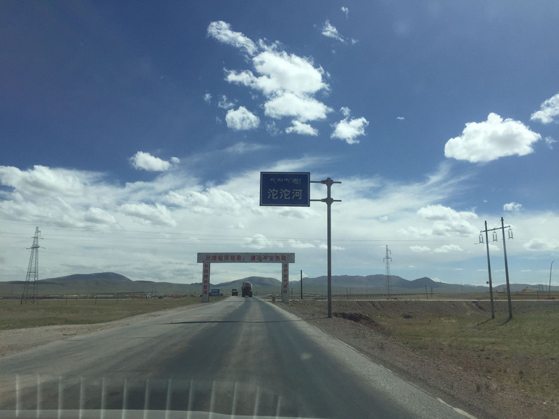
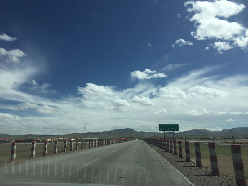
The Luohe River is located in the hinterland of the Qinghai-Tibet Plateau in the south of Qinghai. The source is the plateau snow mountain melting into water. It belongs to the Yangtze River water system. It will cross the Luohe River when driving the Qinghai-Tibet Highway. The Qinghai-Tibet Railway also built the Luohe Railway Station.
;
Tuotuo River Review
4.5 /545 Reviews


1 / 3

5/5
Tuotuo River
Posted: Feb 19, 2021
Like
 4/5ExcellentOriginal Text
The Luo River is the source of the Yangtze River, originating from the Gladandong Glacier, located in Tanggula Mountain Town, Haixi Prefecture, Qinghai, self-driving Qinghai-Tibet Highway to cross the first bridge of the Yangtze River, at an altitude of 4,700, and the scenery is good.
Posted: Apr 14, 20210 4/5ExcellentOriginal Text
The Luo River is the source of the Yangtze River. Snow mountains along the second bank of the river, glaciers can be seen everywhere. The scenery is beautiful. The vegetation is sparse. The natural conditions are bad and the sunshine is too strong. You must pay attention to sun protection and high reaction when you go there. 400 kilometers from Golmud. You can take the train at Anduo Station of the Qinghai-Tibet Railway. Then take the bus to transfer.
Posted: Sep 10, 20201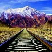 5/5OutstandingOriginal Text
The scene is huge, the momentum is magnificent, it is worth a visit!
Posted: Jun 29, 20230 5/5OutstandingOriginal Text
The Luohe is located in Tanggula Mountain Town, Nanyu Golmud City, Qinghai Province, south of the Cocoa Xili Mountains. It from the Ganggendi glacier of the Gladandong Snow Mountain, is a small stream of some glaciers and ice buckets, when the water surface is only 3 meters wide, only 20 centimeters deep, and then flows north over a distance of more than 9 kilometers, under the Badong Mountain, the glacier of the GaChadi such as the Gangshan Snow Mountain is gathered. Melting water, after a valley about 15 kilometers long, continued north, divided into two small rivers 4 meters wide and 6 meters wide, there are many cobweb-like water in the valley on both sides of the river, here is the upper source of the river. At the exit of this valley, the valley suddenly cut down, forming a steep canyon about 5 kilometers long, up to more than 20 meters. After the intersection of many rivers, the river has formed a wide channel and the river is intertwined.
Posted: Jun 14, 20221 3/5AverageOriginal Text
When the Weihe River originated from the Ganggendi glacier in the Gladandong Snow Mountain, it was a small stream formed by some glaciers and ice buckets, and then flowed north, and the glacier melted water was gathered under the Badong Mountain. There were many cobweb-like water in the valleys on both sides of the river.
Posted: Mar 4, 20221 4/5ExcellentOriginal Text
Leaving Tibet, the source of the Yangtze River, but Tanggula Mountain Town is too dirty... It is all rotten roads, and the car must pay attention to the chassis.
Posted: Apr 11, 20221- 1
- 2
- 3
- 4
- 9
Recommended Attractions at Popular Destinations
Bangkok attraction near me | Tokyo attraction near me | Manila attraction near me | Hong Kong attraction near me | Taipei attraction near me | Seoul attraction near me | Los Angeles attraction near me | New York attraction near me | Shanghai attraction near me | Kuala Lumpur attraction near me | Shenzhen attraction near me | Osaka attraction near me | Singapore attraction near me | London attraction near me | Guangzhou attraction near me | San Francisco attraction near me | Beijing attraction near me | Macau attraction near me | Bali attraction near me | Paris attraction near me | Ho Chi Minh City attraction near me | Orlando attraction near me | Jakarta attraction near me | Phuket attraction near me | Chicago attraction near me | Toronto attraction near me | Fukuoka attraction near me | Istanbul attraction near me | Dallas attraction near me | Cebu attraction near me
Popular Attractions
Dunedin | Bogdan Khmelnytsky's Castle | Canyon Lake Scenic Beach | V Tone Fitness Gym Chicago | Bled Castle | District Sports Stadium | Playa Esmeralda | Tokyo Disneyland | Ludi Cave (Reed Flute Cave) | Patong Beach | Zhangjiajie National Forest Park | Sydney Harbour Bridge | The Riverside Bar | SENTHIL KUMARAN THEATRE | Gongqing National Forest Park | Blue Spring Recreation Area | Jiming Temple | Meiyuan Xincun Memorial Hall | Hou Mountain | Williamston Roadhouse Driving Range | Shiva Temple | Las Villas Sector 2 Park | Rahman Masjid | Park Dworski | Obecní knihovna Černožice | Shiv Temple of Sooraj Singh | Casa Aliaga | BROU SUR CHANTEREINE ATB | Biblioteka 152 | Survival Tactics Paintball - Torbram Adventure Farm
Payment Methods
Our Partners
Copyright © 2024 Trip.com Travel Singapore Pte. Ltd. All rights reserved
Site Operator: Trip.com Travel Singapore Pte. Ltd.
Site Operator: Trip.com Travel Singapore Pte. Ltd.