The taste is average, because there are a lot of people during the festival, the dishes can also be made.
;
Review
5 /56 Reviews


5/5
Posted: Apr 29, 2017

1 person liked this
Like
 5/5OutstandingOriginal Text
Drinking black wolfberry, eating the special sour cold sand onion here, it is very appetizing. This braised eggplant is very special, it feels like fish meat, sour and sweet. I like to eat fried lamb onion, which is fragrant and delicious. Compared with other tour group meals, this one is still possible, with a large amount and affordable.
Posted: Oct 15, 20200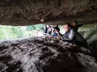 5/5OutstandingOriginal Text
In Shapotou, but the weather in the north is still too cold. Many shops have not been developed. We went to December too. It should be good, it will not open. There may be no tourists.
Posted: Dec 30, 20172 5/5OutstandingOriginal Text
It’s so fun, the children still want to play, next year the weather is warm and the family must buy a package ticket to play!
Posted: Jan 8, 20240 Original Text
#Camping Hiking Wild Happy #Private Treasures around the city Shapotou National Nature Reserve in Ningxia, located in the southeast edge of the Tengger Desert in the west of Zhongwei City, Ningxia Hui Autonomous Region. From the east, the south forest protection house of Erdao Shagou, the west to the headdaodun, the north to the Tengger Desert, the south to the Yellow River, about 38 kilometers long, about 5 kilometers wide, the altitude is 1300 ~ 1500 meters, the total area is 4599.3 hectares, accounting for 3% of the total land area of Zhongwei City. It is one of the 20 key areas in the country to control sand. It is now a national AAAAA-level tourist attraction, a national desert ecological nature reserve, a global environmental protection 500 units, 20 famous landscapes for national fitness, and a special award for scientific and technological progress. Shapotou set the desert, the Yellow River, the mountains, the oasis as a place, with the northwest scenery of the majestic, and the beautiful scenery of the south of the Yangtze River. There is China's largest natural sandboarding field, there is a cross-yellow river "the first rope of the Yellow River", there is the Yellow River culture representing the ancient waterwheel, there is the oldest transport vehicle on the Yellow River sheepskin dumplings, there is a rare mirage in the desert. You can ride a camel through the Tengger Desert, you can ride an off-road vehicle sand sea surf, and you can enjoy the wonders of the desert smoke and the long river setting sun within easy reach. The main protection objects of Shapotou are natural desert landscape, natural sand vegetation, sand control scientific research results, wildlife, ancient Great Wall of Ming Dynasty, sand slope ringing bell and other humanistic landscapes and natural complexes. At the 2018 China Northwest Tourism Marketing Conference and Tourism Equipment Exhibition, it was shortlisted for the "Magic Northwest 100 Views" list. At the 2018 China Yellow River Tourism Conference, it was named the "50 Views of China Yellow River".[1][2] The best leisure tourism destination of the 2018 China National Tourism. [3] Chinese name Ningxia Shapotou National Nature Reserve geographical location Yingshuiqiao Town, Shapotou District, Zhongwei City, Ningxia Hui Autonomous Region[9] temperate continental climate area area 4599.3 hectares of history September 1984, Ningxia Shapotou Nature Reserve was established. A total of eight Shapotou 1986~, the first comprehensive comprehensive inspection of the protected area was carried out in 1987. In April 1994, it was approved by the State Council as a national nature reserve. [5] The urban area of Zhongwei City, which belongs to the geographical location reserve, is located at the western end of Ningxia Hui Autonomous Region, at the junction of Ning, Gan and Meng provinces. The coordinates of the jurisdiction are 104°17′~105°37′, and 36°59′~37°43′. It is located at the head of the Yellow River, south of Xiangshan, north of the Tengger Desert, and the middle of the Yellow River alluvial plain; the total land area is 4599.3 hectares, which is one of the 20 key areas for sand control in the country.[5] The terrain of the geological and geomorphological reserve is high in the northwest and low in the southeast, and it is tilted from the northwest to the southeast. Dunes are crisscrossed, high and low, covered in the second or third epoch red sandstone and high river flood terraces and alluvial flood plains, the protected desert is formed by the forward movement of the Tengger Desert, and the thickness of the sand layer is generally 20 ~ 30m, and the thickest is 50m. Most of the ridge-shaped dunes, crescent-shaped dunes chain, crescent-shaped dunes and lattice crescent-shaped dunes constitute typical wind and sand landforms.[5] The climate protected area is a temperate continental climate, and it is a temperate arid climate area in the national natural division. It has the characteristics of drought and less rain, strong evaporation, large temperature difference between cold and hot, sufficient light, wind and sand, long winter and cold summer, late spring, early autumn and more meteorological disasters. The average annual total solar radiation is6.2 × 10J/m, the number of sunshine hours 2776.72 hours, and the average annual temperature 9.6℃. The minimum temperature in January is -25.1℃. The maximum temperature in July is 38.1℃, the annual difference is 63.2℃, ≥ 10℃ accumulation temperature 3017℃, and the frost-free period of ≥ 0℃ averages 179 days. The average annual precipitation is 186.6mm, and the annual evaporation is 3000mm. It is 16 times the average annual precipitation, dryness 2.4, the number of wind and sand hours in the year reaches more than 900 hours, the average annual wind speed 2.8m/s, the wind and sand days are more than 3 ~ June, and the maximum wind can reach eighth grade. High winds often accompany sandstorms, and the average annual sandstorm days are 5 ~ 19 days. The wind direction is mostly northwest wind. The main disaster weather is drought, frost, high winds, heavy rain, hail, hot dry wind, low temperature and cold damage.[5] There are 5 Shapotou scenery in total, and the surface water of Shapotou hydrological reserve in total is mainly the transit Yellow River water, atmospheric precipitation runoff and spring water lakes. The runoff flow of the Yellow River during the abundant and dry water periods has changed greatly, and the natural ratio of the water surface has dropped to about 1/1300, the flow rate during the flood period 2.2~4.0m/s, the normal water period 1.7~3.0m/s, and the dry water period 0.77~2.0m/s. The average water depth flood period 1.8~8.7m, the normal water period 1.7~5.2m, and the dry water period 1.6~3.7m. The average flow rate is 1038m/s. Due to the control of the base structure, some closed inland lake basins have been formed. For example, alkali-alkali lake, small lake, high-dun lake, horse farm lake, barren grass lake and other inland lakes, the total area is 721 hectares, which is the habitat of a variety of vertebrate groups in the region. [5] The soil types of sandpotou reserve are more complicated, with 6 soil types distributed, the total soil area is 13262.6 hectares, mainly wind and sand, and there are still gray calcium soil, tidal soil, new soil, irrigation and silt soil distribution. Wind and sand soil area is 10,610 hectares, accounting for about 80% of the total soil area of the reserve; The area of gray calcium soil is 1,127 hectares, accounting for8.5% of the total area of the protected area; the area of tidal soil is 1,326 hectares, accounting for 10% of the total area of the protected area; in addition, the total area of new accumulated soil, irrigation and silt, and salt soil is only 199.6 hectares, accounting for 1.5% of the total area of the protected area. [5] The regional scope of Shapotou National Nature Reserve from the east to the south of Erdao Shagou forest protection house, west to the Toudao Dun, north to the Tengger Desert, the Shapotou section extends 1000 ~ 2000 meters to the north, and extends 300 ~ 500 meters to the periphery of Dingbei Dun along the baseline of the second phase of the "Sanbei" protective forest. South to the Yellow River, about 38km in east and west, 5km in south and north, geographical coordinates: 104°49′25″~105°09′24″, 37°25′58″~37°37′24″. There are 6 administrative villages in Shapotou Village, Mingzhong Village, Heilin Village, Jiadao Village, Mengjiawan Village, and Changliushui Village in the protected area.
Posted: Feb 21, 20230 5/5OutstandingOriginal Text
Eating is very good, the environment is good, the seed noodles are very tasteful and cooked.
Posted: Oct 2, 20180
Recommended Attractions at Popular Destinations
Bangkok attraction near me | Tokyo attraction near me | Manila attraction near me | Hong Kong attraction near me | Taipei attraction near me | Seoul attraction near me | Los Angeles attraction near me | New York attraction near me | Shanghai attraction near me | Kuala Lumpur attraction near me | Shenzhen attraction near me | Osaka attraction near me | Singapore attraction near me | London attraction near me | Guangzhou attraction near me | San Francisco attraction near me | Beijing attraction near me | Macau attraction near me | Bali attraction near me | Paris attraction near me | Ho Chi Minh City attraction near me | Orlando attraction near me | Jakarta attraction near me | Chicago attraction near me | Phuket attraction near me | Toronto attraction near me | Fukuoka attraction near me | Istanbul attraction near me | Dallas attraction near me | Chiang Mai attraction near me
Popular Attractions
Nancy Island Historic Site | Boracay Island Sunset Sailing | Hells Gate | Emperor Qinshihuang's Mausoleum Site Museum | Lake Rotorua | Empire State Building | Nanhai Guanyin | Banpo Bridge Moonlight Rainbow Fountain | Waiotapu Thermal Wonderland | Tokyo Disneyland | Hobbiton™ Movie Set Tours | Sichuan Museum | Cloud 9 Fiji | Klein-Kariba | Parc du jardin perdu | Shanghai People's Park | Cliff of Thousand Buddhas | Sree Rama Bakhta Hanuman Temple | tuin linverhof | Mohawk River Trail | Spot Park Horigome | Stade Sendwe, Kalemie | Jardinete Sem Nome | Noorani Masjid | Shri Jnanashakthi Subrahmanyaswami Temple, Nagavruja Kshetra Pavanje | La Comarca del Rio Negro | Footlite Musicals | Infantil Santa Rosa Park | Barranco de Guayadeque | West Street
Payment Methods
Our Partners
Copyright © 2024 Trip.com Travel Singapore Pte. Ltd. All rights reserved
Site Operator: Trip.com Travel Singapore Pte. Ltd.
Site Operator: Trip.com Travel Singapore Pte. Ltd.