https://nz.trip.com/moments/poi-temple-hill-137270817
1.7
5.0/5
1條評論
Mountain climbing
Temple Hill的地址:
Hong Kong
✨【Hidden D
✨【Hidden Delights in Tsz Wan Shan! A must-try at Twin Shop: Humane Fried Chicken x Hong Kong-style Beef Brisket Pizza|Fried with Juice + Cheese Waterfall】✨
🏡【Basic information of the store】
📍Address: Shop 2, G/F, Tsz Lok Building, Tsz Lok Estate, Tsz Wan Shan
⏰Opening hours:
Monday to Tuesday, Thursday to Sunday 11:00-22:00
⚠️Closed all day on Wednesdays
💰Consumption: Within $60 per person | Cash only💵
☎️Order hotline: 2133 4149
———🍗 Three great reasons why neighbors are crazy about it ———
🔥【Fried Chicken at the Town Store|Subverting the Perception of Chain Stores】
✔️Giant chicken thigh fried on order! 🍗The moment you cut it, the steam rises, and the crispy fried flour locks in the gravy💦
✔️Eat your fill of boneless meat, the tenderness is better than that of a certain grandpa's fried chicken👴🏻
🍕【Hong Kong-style Fusion Pizza|Cheese lovers scream】
▪️The first curry beef brisket pizza:
🥘Hong Kong style coffee beef brisket crossover with brushed mozzarella cheese🧀
▪️The golden ratio of half-thick base:
Crispy edges and soft core, available in three sizes (6/9/12 inches)
▪️The baked rice series is super foul! White sauce seafood rice topped with double cheese 🧈
▪️👩🍳【Human touch is overwhelming|The boss lady brings her own warmth】
———📝 Test Report & Strategy ———
⚠️ Note:
① Only 4 tables for dine-in! ⏰It is recommended to arrive before 17:00
② Enjoy 5% off for takeaways, and wait 30 minutes during peak hours⏳
💡 Neighborhood Rating:
• Value for money: ★★★★★ ($60 and you’ll be full)
• Surprise level: ★★★★☆ (Hong Kong-style creativity beats chain stores)
• Return rate: ★★★★★ (I will come again just for the boss lady’s smile)
🎯 Summary: The ceiling of Tsz Wan Shan Neighborhood Canteen! Although the decoration is simple, every meal is carefully prepared. Especially recommended for cross-border tourists to experience the authentic Hong Kong human touch, remember to bring enough cash to support the shops~👛
#Hong Kong-style snacks #Hidden food #Must-have for cheese lovers #Recommended by Hong Kong residents
Arvin_hungg213
🎏Tsz Wan Shan Village Central Playground joins the Lunar New Year Fair for the first time🧧
The Lunar New Year Fair in Lok Fu Morris Park, this year changed to the central playground of Tsz Wan Shan Village, the scene saw the environment, strong!! ️ wide!! ️ down!!
There should be about 15 stalls, the best is the fast food area, the whole place only one stall😂 also sell fishball siu mai, $ 10 to have four, but it is purely a pot, pot a pot like this, I did not eat it🤪
📍2025 Tsz Wan Shan Estate Central Playground Lunar New Year Fair
#circle_life #circle_foodie #blogger #hongkongblogger #Hongkongfood #HongKongFoodDiary #HongKongFoodRecommendations #HongKongFoodMap #HongKongFoodSharing #HongKongFoodRecommendations #TszWanShan #TszWanShanFood #CentralPlayground #LunarNewYearFairMarket #Loneliest Deli Stall #Fishball Siu Mai #Flower Market
Misscircle
"Times Ice House (Tsz Wan Shan)"
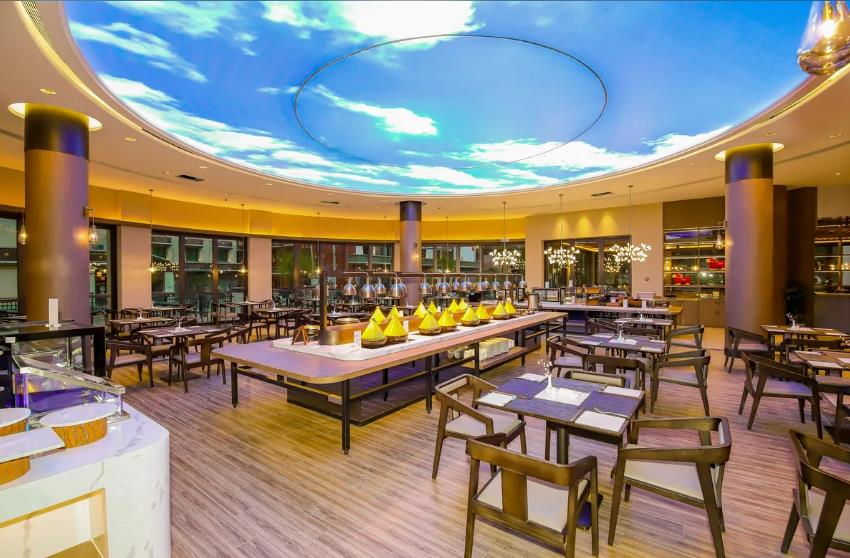
Last Sunday, we went to Times Ice Cream Parlor (Tsz Wan Shan) for breakfast. Since we were 2 people, we ordered 2 breakfasts, namely all-day breakfast (Gillette fish fillet) and Da Times regular meal.
1. All day breakfast (Gillette fish fillet): Contains are quite rich, including: scrambled eggs, Danish toast, potato pancakes, sausages, ketchup beans, mini tomato soup macaroni + meals (regular hot drinks do not pay extra, cold drinks or soda to add). The macaroni and tomato flavor is enough, sweet and sour quite appetizing, the fish fillet is fried crispy and tender inside, there are many pieces, the scrambled eggs are not very tender, but the taste is good, the fries are fried just right, crispy and delicious, other normal play.
2. Big time regular meals: self-selected dishes + noodles + eggs + buns + meals.
The satay beef noodles are not very juicy, but they have been seasoned, so they taste satay, the taste is good, not tough, the pasta is soft and hard, the ham tenderness is moderate, with Danish toast, is quite good.
The package is not seen in the picture, because it has been eaten before the photo, so it is gone, as for the meal, because it appeared after the meal, so not seen.
The staff service attitude is friendly and courteous, the environment is comfortable to sit.
littlecream99
Mountain cows
A Japanese charcoal-grilled beef rice restaurant with a reputation for high quality and affordable prices has arrived in Hong Kong. It has 24 stores in Japan, specializing in freshly cut and grilled beef. The first must-try signature dish is the "Charcoal-grilled Beef Short Rib BBQ Don". The restaurant's unique charcoal-grilled slow-cooking method not only keeps the beef tender and juicy, but also gives off bursts of charcoal-grilled aroma. It is top-notch when topped with yakiniku sauce and rice. You can also add a set meal with chive oxtail soup and Japanese karaage chicken. It is a popular restaurant recommended by many Japanese yakiniku lovers.
Yakiniku Yamagyu
Address: Unit 1-3, G/F., Tsz Wan Shan Centre, Wong Tai Sin, Kowloon
#Register for June hotel test sleeper #BBQ
crystalbibee
Hong Kong Peaks⛰ - Tsz Wan Shan
#SpringGood Places2024
"Tsz Wan Shan" is located in Wong Tai Sin District, East Kowloon. From Tsz Wan Shan Estate Bus Station as a starting point, walk up the mountain. There is a little bit of bad land at the beginning, then the stone steps are mainly, with different heights. Stepping over these stone steps requires a brain test.
After almost a while, you will turn to the road road, which is wider and can move around easily and freely.
#HongKong Countryside
#HongKongTravel Guide
#HongKongGood Places
ExploreYourInterests
2

Recommended themes

Guides
7 posts
Restaurants
6 posts
The 23rd stop of hiking in Hong Kong—Wilson Trail Section 4 and 5
Wilson Trail Section 4 and 5 from Jinglan Tree to Tai Po Road (W032—060), with a total length of 14.5 kilometers (actually walked 19.7 kilometers, climbed 1800 meters, descended 1900 meters), took 5 and a half hours. The speed is slower than before, mainly because I added some projects.
Section 4 is from Jinglan Tree to Sha Tin Au (W032—046). You can find the W032 marker pole in Jinglan Tree Village, cross the village, cross a mountain, and arrive at Dalanhu Village. Starting from W037, there is a continuous two-kilometer climb to the top of Dongyang Mountain (533 meters). This is also the most difficult part of the entire Section 4. There is no elevation pole on the top of Dongyang Mountain, but you can look north to Sha Tin, look down on Sai Kung to the east, and look at Victoria Harbour to the south (Figure 4). The view of Sai Kung Bay here is particularly beautiful, with scattered islands like Thousand Island Lake, and the yachts are like pearls. From Dongyang Mountain down, it is basically along the road. Passing by Dalao Mountain Viewing Platform, there are two viewing platforms (Figure 7 and Figure 8). Figure 7 is by the road, overlooking Victoria Harbour; Figure 8 requires a little climb (Dongshan, 544 meters), overlooking Sai Kung. Continue to move forward, I turned right to the top of Dalao Mountain (Figure 13, 577 meters), which is a weather station. After passing W043, at the historical viewing platform (Figure 14) overlaps with MacLehose Trail Section 4, the weather was not good when I walked MacLehose last time, but it is clearer today. Continue along the road to Sha Tin Au, after walking this section, I went up the small road from Diaocao Rock to the top of Tsz Yun Mountain (Figure 15, 488 meters), which is a TV station's transmission station. Downhill along the mountain road, return to the end of Section 4, Sha Tin Au Lion Pavilion. Overlooking Victoria Harbour along the way, the scenery is picturesque.
Section 5 is from Sha Tin Au to Tai Po Road (W047—060). Wilson Trail separates from MacLehose at Sha Tin Au and goes north along the road opposite the Lion Pavilion. The entire Section 5 is not difficult, basically there is no climbing, all are flat roads and downhill roads. The scenery is also relatively boring, mainly looking at Sha Tin, overlooking Tai Mo Shan. After passing W053, you can look up to see the Husband-watching Rock (Figure 18). I walked an extra kilometer to climb to the Husband-watching Rock, which is an excellent angle to view Sha Tin (Figures 19 and 20), but the round trip consumes a lot of physical strength. After W058, I started to see 🐒 groups. Continue along the aqueduct, pass W060 down to Tai Po Road, turn right is the bus station.
Violet.Simmons.55
""
There are many kinds of seafood, and the price is very cheap
ToToR
Small Wonton Shop
Today I went to Tsz Wan Shan to eat at a restaurant called Panda Wonton. They are famous for their wontons and I like them, so I decided to give it a try. I had to pay, then look at the screen to see the number, and wait for the food to be picked up. I picked up the drinks myself.
Fresh shrimp and pork wontons $32/10 pieces
The shrimps are fresh and chewy, the wonton skin is soft and smooth, and I chose the shrimp and seaweed soup, which is so sweet and delicious.
Grandma's Braised Pork with Scallions and Hot Noodles $58
The braised pork has a rich flavor, the noodles are chewy, and the shallots are soaked in the noodles, which is very appetizing. There are also vegetables, radishes and other side dishes, which are very rich😋
Hot noodles with pork chop and fried shallots $55
The pork chop is crispy and delicious, the noodles are topped with shallots, and there are also side dishes provided, very rich 😚
Preserved Egg with Preserved Rice $22
The cold preserved egg has a good preserved egg aroma, and with the addition of seasonings such as soy sauce, vinegar, and peppercorns, it is a very appetizing snack😋
Countryside cucumber salad 🥒 $24
Cucumber is very crisp and refreshing when bitten. Adding vinegar, sugar, pepper, etc. makes the taste fresh and sweet😚
Pear Tea $12 (with meal)
It tastes cool, sweet and slightly aromatic, good for relieving summer heat🥵
Cold Brew Roselle Tea $12 (with meal)
Hibiscus tea has a sweet and sour taste and rich aroma, which is very suitable for drinking in hot weather🥵
Overall score: 4/5
Taste: 4/5
Environment: 4/5
Value for money: 4/5
🎇Panda Wonton (Tsz Wan Shan Shopping Centre)
🎈Shop 327-328, 3/F, Tsz Wan Shan Shopping Centre, 23 Yuk Wah Street, Tsz Wan Shan
@pandawonton_hk
eateatlam
Post
更多推薦
Recommended Attractions at Popular Destinations
Popular Attractions in Barcelona | Popular Attractions in Los Angeles | Popular Attractions in Chefchaouene | Popular Attractions in Beijing | Popular Attractions in Tokyo | Popular Attractions in Dubai | Popular Attractions in Bangkok | Popular Attractions in Phuket | Popular Attractions in Bali | Popular Attractions in Kuala Lumpur | Popular Attractions in Singapore | Popular Attractions in Sydney | Popular Attractions in Las Vegas | Popular Attractions in New York | Popular Attractions in Kyoto | Popular Attractions in Walt Disney World Resort | Popular Attractions in Paris | Popular Attractions in Shanghai | Popular Attractions in Melbourne | Popular Attractions in London | Popular Attractions in Rome | Popular Attractions in West Lake | Popular Attractions in Osaka | Popular Attractions in Iguazu National Park(Argentina) | Popular Attractions in Chengdu | Popular Attractions in Madrid | Popular Attractions in Jungfrau Region | Popular Attractions in Zanzibar Island | Popular Attractions in Florence | Popular Attractions in Hong Kong
Popular Ranked Lists
Top 10 Luxury Hotels in Amsterdam | Top 10 Trending Attractions in Changchun | Top 50 Must-Visit Restaurants in Kyoto | Top 20 Luxury Hotels in Rome | Top 10 Trending Attractions in Qinhuangdao | Popular Premium Hotels in Emboodhu Finolhu | Top 10 Luxury Hotels in Munich | Popular Trending Attractions in Dunhuang | Top 10 Must-Visit Restaurants in Bad Ischl | Top 10 Luxury Hotels in Geneva | Top 50 Must-Visit Restaurants in Chengdu | Top 10 Luxury Hotels in Budapest | Popular Luxury Hotels in Helsinki | Popular Trending Attractions in Dali | Top 50 Must-Visit Restaurants in Munich | Popular Luxury Hotels in Central Java | Popular Trending Attractions in Seoul | Top 10 Trending Attractions in Jinan | Popular Luxury Hotels Near Longnan | Popular Luxury Hotels Near Zoige | Top 50 Must-Visit Restaurants in Bangkok | Top 50 Must-Visit Restaurants in Songyang | Popular Trending Attractions in Kaifeng | Top 50 Must-Visit Restaurants in Xi'an | Top 10 Luxury Hotels in Cairo | Popular Luxury Hotels Near Zhouqu | Popular Luxury Hotels in Shima | Top 50 Luxury Hotels in Paris | Popular Trending Attractions in Yinchuan | Top 50 Must-Visit Restaurants in Madrid
About
Payment methods
Our partners
Copyright © 2025 Trip.com Travel Singapore Pte. Ltd. All rights reserved
Site Operator: Trip.com Travel Singapore Pte. Ltd.
Site Operator: Trip.com Travel Singapore Pte. Ltd.