https://nz.trip.com/moments/destination-lantian-2755/
2025 Lantian Travel Guide: Must-see attractions, popular food, hotels, transportation routes (updated in October)
Lantian is situated in Shaanxi province on the northern side of the Qin Mountains, close to the provincial capital Xi'an. In ancient times it was renowned for its jade. The fossilized remains of a Homo erectus skull were found here, which provided valuable evidence for research into human evolution. The Chinese film White Deer Plain (based on the eponymous novel) was also filmed here. Tourists can visit the filming location and learn about the area's history. Other popular attractions include Tangyu Bishuiwam Hot Spring Resort and a memorial to the Han dynasty poet and musician Cai Yan.
Lantian Today's weather
Light rain 8-13℃

Trending in Lantian
Popular Attraction in Lantian
Shuilu Temple
(30)Bai Lu Yuan Studios
(9)All Trip Moments about Lantian
This is probably the ultimate aesthetic that is indelible in our ancestors’ bones.
It’s not Xiaoxitian…it’s Lantian Shuilu Temple‼ ️ It is a seriously underestimated free and unpopular attraction in Xi'an Known as "China's No. 1 Dunhuang" and "the world's No. 1 painted murals" It is also one of the filming locations of "Black Myth: Wukong" . Look up 👀 Gods and Buddhas everywhere, paradise, palaces and pagodas, carved beams and painted buildings More than 3,700 clay sculptures with lifelike expressions and stunning carving details Once again, I was amazed by the ultimate aesthetics engraved in our ancestors’ bones‼ ️ . 🏯|Shuilu Temple 📍|Hewankou Village, Puhua Town, Lantian County, Xi'an City, Shaanxi Province ⏰|9:00-16:30 🎫|Free, no reservation required 🚗|Start from downtown Xi'an, take the subway to Textile City, and then take a taxi (about 60r one way, it is more convenient to take a taxi back and forth) ⚠️|The rear hall of the main hall is currently under restoration, and only the front hall is open to the public. The pictures were taken on March 12, 2025. The contents shown are all accessible areas for your reference. Photography is allowed in the hall, but flash photography is not allowed. .Henry~Harris-Alexander4Xi'an, just 1 hour away! Discover the real-life "Mini Dunhuang"
While others flock to the Terracotta Army and Muslim Street in Xi'an, I've unearthed a hidden gem—Shuilu'an Temple—a truly awe-inspiring journey of discovery. ⛩️ Shuilu'an Temple, a hidden artistic treasure in Lantian County, Xi'an, is known as the "Mini Dunhuang." It houses over 3,700 colorful clay sculptures from the Ming Dynasty, which, despite over 500 years of history, remain vibrant and lifelike. Stepping inside feels like stepping back in time, instantly transporting you to ancient times. The walls and pillars are covered in exquisite clay sculptures, each silently narrating ancient Buddhist stories. The Hall of Five Hundred Arhats is the absolute highlight of Shuilu'an Temple! Each of the five hundred arhats has a unique posture and expression. Some appear serene, as if pondering Buddhist doctrines; others have piercing gazes, seemingly perceiving all worldly phenomena. The intricate details make you feel as if they might step down from the wall and converse with you at any moment. 🚗 Transportation Tips: It's about a 1-hour drive from downtown Xi'an. Driving or hiring a car is very convenient, allowing you to enjoy the scenery along the way. 🎫 Ticket Information: Free! Free! Free! It's worth repeating—it's incredibly budget-friendly! Opening Hours: 8:30 am - 5:30 pm. It's recommended to allocate 2-3 hours for a leisurely visit. Special Reminder: To better protect these precious cultural relics, photography is prohibited inside the temple. Perhaps the best way to cherish the beauty is to keep it in your heart.CHARLEE HOUSTON31-hour Xi'an surrounding tour | Drive directly to Xiaoxi Tian.
| Drive directly to Xiaoxi Tian.📍Detailed address: Lantian, less than an hour's drive, park in the parking lot, walk less than 500 meters, no tickets 🌟Highlights: Six Dynasties famous temple, with ancient colored sculptures inside, a treasure house of ancient Chinese sculpture art, known as "the second Dunhuang of China", the Water and Land Nunnery was originally the Water and Land Hall of Wuzhen Temple, an important place for holding "Water and Land Great Fast" and "Water and Land Dojo" ✅Must-try: Visitors can also bring a notebook, there is a Black Myth Wukong stamp chapter, free stamping 🍲Nearby food: Lantian Impression, very crowded, wave after wave, may need to queue, but delicious and affordablePluie?toilesSereine12Shaanxi Province, China | Xi'an City | Lantian County | Shuiluan Nunnery.
|Xi'an City | Lantian County | Shuiluan Nunnery. [Unveiling the Mystery of Shuiluan Nunnery in Lantian, Xi'an, Experience the Exquisite World of Ming Dynasty Colored Sculptures] Shuiluan Nunnery in Lantian, Xi'an is a historic Buddhist temple located in Puhuazhen Town, Lantian County, Xi'an City, Shaanxi Province. It is famous for its well-preserved Ming Dynasty colored clay sculptures, and is known as the "Second Dunhuang of China". The nunnery's exquisite group sculptures include Five Hundred Arhats Crossing the Sea, Twenty-Four Divine Generals, and Heavenly Palaces, which have high artistic and historical research value. [🚙 Transportation] 1. Self-driving🚘: From Xi'an city center, take the Xi'an-Lantian Expressway and head towards Puhuazhen Town after reaching Lantian County. Follow the road signs to reach Shuiluan Nunnery. 2. Public transportation🚃: At the East Square of Xi'an Old Train Station, take the red bus to Lantian County Bus Station. In Lantian County, transfer to a minibus heading to Wangshunshan and get off at Shuiluan Nunnery. 3. Metro📍: Take Metro Line 1/6/9 to Fangzhicheng Station, take the Lantian Tourism Bus Special Line, get off at the terminal station and walk to the Disease Control Center Station. Transfer to Lantian Tour Line 2 to reach Shuiluan Nunnery. [💰 Fees] 1. Tickets: Currently, Shuiluan Nunnery is free for visitors and no reservation is required. 2. Guide service: Self-service audio guide 10 yuan, human guide 100 yuan (subject to actual conditions on site). [👣 Route] 1. Scenic Route 1: Visitor Center → Mountain Gate → Front Hall → Middle Hall → Main Hall (All Saints Water and Land Hall) → Back Hall → Exit. 2. Scenic Route 2: Visitor Center → Mountain Gate → Left and Right Side Halls (Exhibition Area) → Main Hall (All Saints Water and Land Hall) → Middle Hall → Front Hall → Exit. [💡 Warm Tips] 1. Best season: All year round, but spring and autumn are more comfortable due to the pleasant climate. 2. Equipment suggestion: Please wear comfortable clothes and shoes for easy sightseeing.yara_65763Drive from Xi'an to the unmanned meadow in the sky and reach the top 100%.
Drive from Xi'an to the unmanned meadow in the sky! 100% to the top. A new treasure has been discovered, a free campsite It takes about 1 hour to get there from Xi'an You can drive directly to the meadow platform in the sky Not many people know about it at present, so it's quiet, beautiful and not crowded I even saw a sea of clouds that morning!! The view is amazing!!! 📍Address: Near Wangjialing, Jiaodai Town, Lantian, navigate directly to "Jiaodai Zhangling" (don't navigate to Zhangling Village! One word less!) 🚗Road conditions: The whole journey is cement road, which is easy to drive. The road section to the top of the mountain is a little narrow and not easy to meet, but there are not many people and cars herelucatravel4An hour's departure from Xi'an, I found the Mars base here
No need to go to the northwest to see the colorful Danxia, an hour's departure from Xi'an, there is also beautiful Danxia scenery here, the unique terrain is like being at the "Mars base", this is the Danxia landform viewing spot located on the Huayang Ring Line in Lantian County, Xi'an. How to get there: Depart from Xi'an, directly navigate to "Huayang Ring Line Danxia Landform Viewing Spot" to arrive. Photo tips: 1. Definitely bring a drone, because the aerial view and the scenery and color seen from the ground are completely different, which is why many people say they were "deceived". 2. If you really don't have a drone, there are high points near the viewing platform (with chess pieces inserted on top), you can also take pictures by climbing up. 3. It is recommended to shoot the drone from above, you can shoot the texture and terrain of the ground. 4. It is recommended to bring people or vehicles, with a size comparison of objects, you can show the grandeur of the Danxia landform. 5. It is recommended to come here when the weather is good (with sunlight), because of the light, the reflection of the Danxia landform will look better. 6. It's also good to come here after the snow, the distant snow-capped mountains feel very Sichuan. Other suggestions: 1. There is a parking area on the viewing platform, but the charge is 5 yuan per car. If you don't want to spend money on parking, you can park at the fork in the road behind. 2. The road is relatively narrow, and it is difficult to meet cars. Remember to give way to each other when you encounter oncoming cars. 3. There is nothing to eat here, you can fill your stomach on the main street of Huaxu Town before coming. 4. Danxia has completely different colors when shot in different light, different weather, and different perspectives. If you don't have a drone, it is not recommended to make a special trip. 5. The back of the mountain road has snow, please drive slowly. Lantian DanxiaD@v.d M00r322Spend a romantic time hidden in the mountain dwellings around Xi'an
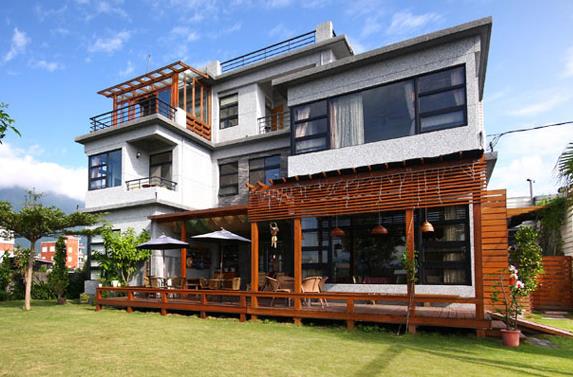
Spend romantic time hidden in the mountain dwellings around Xi'an Spend romantic time hidden in mountain dwellings around Xi'an. There is nothing else in the mountains, and there is no leisure in the years ★Around Xi'an, there is a paradise-like B&B Hidden in the mountain dwelling, sleep with the stars at night, wake up early in the morning by the sound of birds chirping ~ One house, one courtyard, one hot spring It is a B&B at Shoujia Resort in Xi'an It integrates bed and breakfast, camping, mountain restaurant, study and hot spring It is a 1-hour drive by yourself Super beautiful room type view with floor-to-ceiling windows throughout the house Forest bamboo sea terraces are everywhere, you can hike in the forest to have a wonderful hot spring afternoon tea I think this is the most romantic life in the mountains Not far from the bed and breakfast there is also a love shaped lake to explore ~ From the city to the mountains | Negative emotions are thoroughly released Mountain dwelling | The way life was Forest extends, streams rush rocks stand firm, fog fills . Fangruo ●Taohuayuan Resort is a B&B Address: Baoxing Temple Village, Puhua Town, Lantian County, Xi'an City Stay in a hotel in TigerNoahO Donnell088Monument Valley Xi'an Branch Valley | Surrounding Tour | New Photo Holy Land
Monument Valley Xi'an Branch Valley | Surrounding Tour | New Photo Holy Land 📍Location: Bailuyuan Film City Xi'an is an hour's drive away with no admission fee 🌈The town is colorful, with a feel of Monument Valley! Super photogenic, there are also bamboo ladder sea of clouds, retro Republic of China street, sky realm (charged project) and Ferris wheel are very photogenic! 🎢There are many amusement park suitable for children to play, such as Ferris wheel bumper cars and so on! 🥘There are many Shaanxi special delicacies in the food street, you can also choose to camp barbecue hot pot are very nice! 🎭Various performances: Erhu Chang'an live performance, magic princess fairy tale drama, night talk Bailuyuan Valley light show...... 📸There are also real villages where Bailuyuan TV dramas are shot, every courtyard and room furnishings are exactly the same Didn't expect such a big change! Worth a good stroll!DAKOTA DOYLE34I was in Xi'an and its surroundings this weekend! My friends all thought I was abroad!
Weekend around Xi'an! My friends thought I was abroad! —— I was asked n times by people in my circle of friends! It’s really in Xi’an! I didn’t go on vacation by the sea Yunjian.Mortal Dust Bed and Breakfast —— √ The small courtyard B&B with a swimming pool is also very nice Right next to the buckwheat sea of flowers independent design sense full of no filter by the way a shot is very out of the film —— √ Each room has a panoramic floor-to-ceiling window You can see the mountain view from the room When the sun sets and there is sunset, it is simply beautiful to cry. There is a rooftop in the yard for barbecue, hot pot, Chinese food. The Chinese food we ordered was really good. It was simply too suitable for vacation —— √ Also bring private soup pool! Disposable toiletries super full yard There is also a piece of children's play area .. slide, swing, Lego, seesaw.... Too suitable to relax and stay comfortable for 2.3 really like living here every day!JUNE BLAKE47Drunken Label Hainanese Chicken Rice
Today after going to Kwun Tong and then going to Lam Tin to meet customers, after meeting really tired and hungry, passing by a only do takeaway "only do smooth chicken" 🐣 drunk label Hainanese chicken rice attracted, so buy to fill the stomach, I found out that it was good! Boneless Hainanese chicken rice I myself think sincerely recommend, is its signature signature dish The chicken is really smooth, boneless is especially easy to enter, ordered more tasty with sauce! Garlic white meat Just right fat and lean, not greasy portion a lot Also a surprise is that they also make homemade desserts, especially mine is milk stewed snow peas, not too sweet, very rich and nourishing ingredients, extremely satisfying!Lingyaulingling16Dinner at Harbour Restaurant: Lamb Pot Warms the Heart
As we enter November, the weather in Hong Kong starts to get cooler, with the temperature dropping even more on some days. That night, I had dinner with my family at the Harbour Restaurant in Lam Tin, chatting while eating. The total area of the harbor in Lam Tin is very large and spacious, and it is very comfortable to sit in. We ordered a few side dishes that night, including lamb belly pot, stir-fried celery and mustard greens, sweet and sour pork, braised tofu, etc. The lamb belly pot was a pleasant surprise. The lamb brisket pot comes with lettuce and costs $180. The restaurant provides a gas stove to keep the lamb brisket hotpot warm. The whole mutton belly pot has many pieces of mutton, mutton belly, and some water chestnuts, and the sauce is rich and fragrant. Open the lid of the pot, and a burst of fragrance will immediately hit your nose; put a piece of mutton in a small bowl, and you will feel a surge of hot air; put the mutton in your mouth, the mutton is not tough, it is chewy, and has a little smell of mutton, but not too strong. The blanched lettuce absorbs all the essence of the sauce and goes great with rice. I ate lamb belly pot that night, which made me feel warm and satisfied. #Hong Kong Good Places #foodieHappyMaggie21How to Enjoy Xi'an's Mountains and Rivers
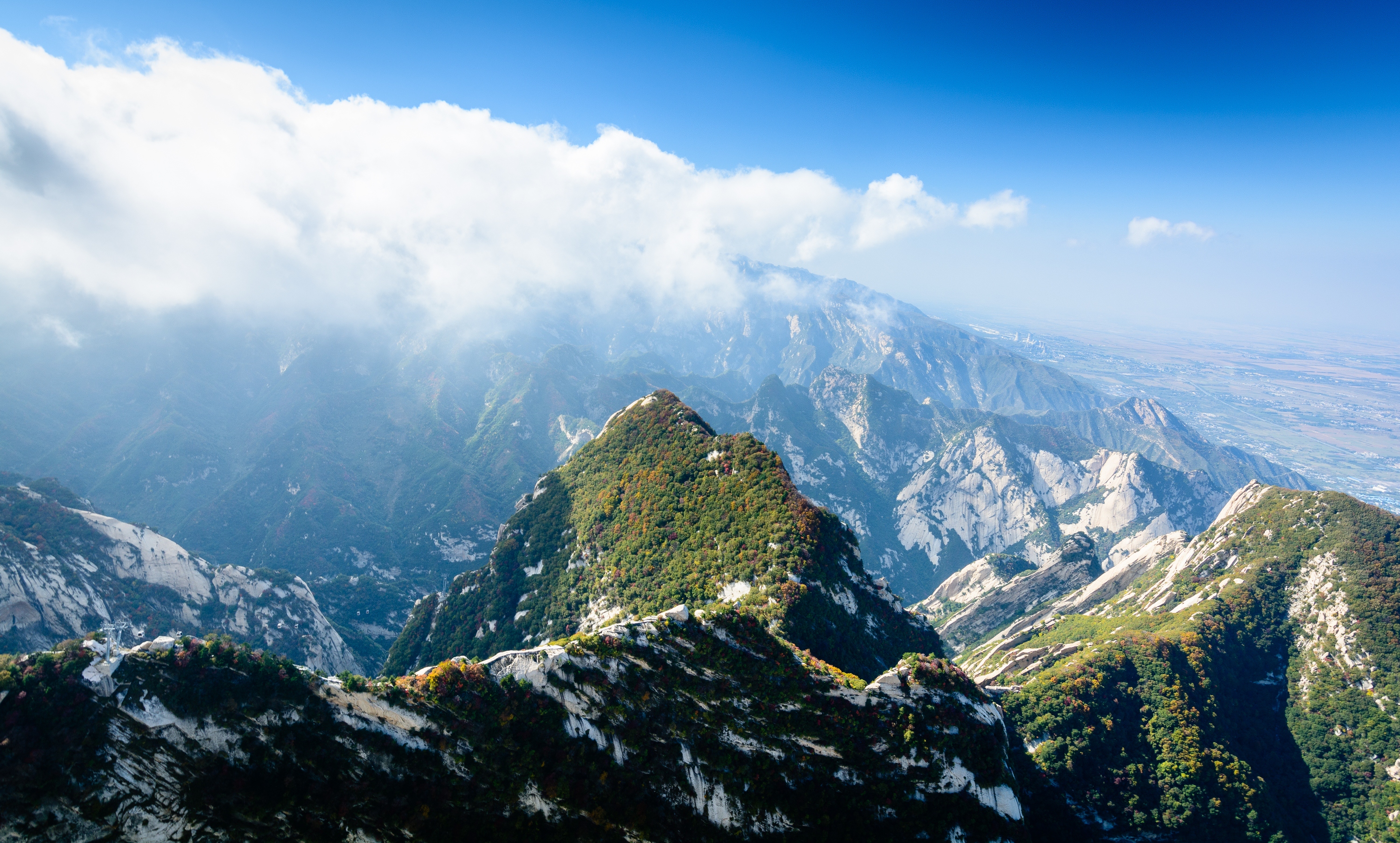
Xi'an Hiking Guide: Trekking Through the Millennia-Old Capital's Landscape Painting Introduction: Xi'an, a city bearing the glorious history of thirteen ancient dynasties, not only boasts profound cultural heritage but also enjoys the magnificent scenery of the Qinling Mountains. Hiking is an excellent way to deeply experience the natural and cultural charm of Xi'an. This article carefully plans several hiking routes suitable for different fitness levels, covering practical information such as transportation, gear, and precautions to help you explore Xi'an's mountains and rivers safely. I. Classic Hiking Route Recommendations 1. Taipingyu of the Seventy-two Valleys in Qinling (Suitable for Beginners) Route Highlights: Taipingyu is famous for its streams, waterfalls, and primeval forests, with distinct scenery in each season—spring flowers in full bloom, cool summer retreats, colorful autumn forests, and snow-covered winter landscapes. Detailed Route: Start: Taipingyu Entrance (accessible by Mountain Ring Tour Line 1 or by car) Pass through: Sanqiaoyu - Lovers' Creek - Rainbow Waterfall - Longtan Waterfall End: Taiping Forest Park (return the same way or take the park shuttle) Hiking Distance: About 10 km (round trip) Duration: 4-5 hours Elevation Gain: About 500 meters Tips: Facilities in Taiping Forest Park are well-equipped, including dining and rest areas. Be cautious of slippery paths during the rainy season; some sections require wading. 2. Zhongnanshan Ancient Trail (Suitable for Intermediate Hikers) Route Highlights: Zhongnanshan has long been a retreat for hermits; the ancient trail is lined with temples and rich in cultural atmosphere, offering panoramic views of the Guanzhong Plain. Detailed Route: Start: Cuihua Mountain Scenic Area (take Metro Line 2 to Weiqu South Station, then transfer to a bus) Pass through: Tianchi Temple - Nanwutai - Zigeyu End: Zigeyu Entrance (return via Mountain Ring Tour Line 2) Hiking Distance: About 15 km (one way) Duration: 6-7 hours Elevation Gain: About 800 meters Tips: Nanwutai Scenic Area requires a ticket; check opening hours in advance. Some sections are steep; wear anti-slip hiking shoes. 3. Huashan Plank Walk (Suitable for Advanced Hikers) Route Highlights: Known for its steepness, Mount Hua in the West is famous for the Plank Walk, an extreme challenge that offers breathtaking sea-of-clouds sunrises. Detailed Route: Start: Huashan Visitor Center (take high-speed rail to Huashan North Station, then transfer to the park shuttle) Pass through: North Peak - Canglong Ridge - East Peak (sunrise viewing) - South Heavenly Gate - Plank Walk - West Peak End: Descend via West Peak cable car Hiking Distance: About 12 km (circular route) Duration: 8-10 hours Elevation Gain: About 1000 meters Tips: The Plank Walk requires an additional ticket and has age and health restrictions. It is recommended to arrive at Huashan a day early and stay near East Peak for sunrise viewing. 4. Zhuque National Forest Park (Suitable for Families) Route Highlights: Featuring primeval forests, alpine meadows, and glacial relics, this park is ideal for family leisure hikes and parent-child interaction. Detailed Route: Start: Zhuque Forest Park Gate (recommended to drive or charter a vehicle) Pass through: Ice Crystal Peak - Guatian Flying Waterfall - Alpine Meadows End: Return the same way or take the cable car down Hiking Distance: About 8 km (round trip) Duration: 3-4 hours Elevation Gain: About 400 meters Tips: The park offers trails of varying difficulty; choose according to your stamina. Take sun protection in summer; some areas may be closed in winter. II. Best Seasons for Hiking Spring (March-May): Mountain flowers bloom, temperatures are moderate, but beware of late cold spells. Summer (June-August): The depths of Qinling are cool and pleasant; take precautions against heat and sun, avoid hiking at noon. Autumn (September-November): Crisp and refreshing weather with colorful forests, the best season for hiking. Winter (December-February): Some mountain areas have snow; wear anti-slip gear and keep warm. III. Gear Checklist Essential Gear: Hiking boots, backpack, quick-dry clothes, sun hat, sunglasses, trekking poles, headlamp, rain gear, first aid kit. Optional Gear: Knee pads, gloves, insulated water bottle, camera, binoculars. Food and Water: High-energy snacks (chocolate, nuts, etc.), 2-3 liters of drinking water (adjust based on route length). IV. Safety Precautions Plan Ahead: Understand route difficulty and weather conditions; download offline maps. Hike in Groups: Avoid hiking alone, especially on unfamiliar trails. Know Your Limits: Choose routes according to your fitness to avoid overexertion. Environmental Awareness: Carry out all trash; protect the Qinling ecosystem. Emergency: Call 110 or park rescue numbers; stay calm and wait for help. V. Transportation and Accommodation Public Transport: Xi'an has a developed metro and bus network; some scenic spots have dedicated tourist lines. Driving: It takes about 1-2 hours from Xi'an to valley entrances; drive carefully on mountain roads. Accommodation: Plenty of hotels in the city; unique mountain homestays available (e.g., near Zhongnanshan). VI. Nearby Attractions Recommendations Cultural: Terracotta Warriors, Giant Wild Goose Pagoda, Shaanxi History Museum. Natural: Taibai Mountain, Heihe National Forest Park, Zhashui Karst Caves. Food: Muslim Quarter, Yongxingfang for authentic Xi'an snacks. Conclusion: Xi'an's hiking routes unfold like a slowly unrolling landscape painting, with every scene telling a story spanning thousands of years. Whether you are a beginner or an experienced hiker, you will find your own excitement here. Embark on your journey to feel the grandeur of the Qinling Mountains and hear the echoes of ancient trails, allowing your body and mind to be elevated in the fusion of nature and history. Friendly Reminder: This article is for reference only. Please verify the latest route information and park regulations before hiking to ensure a safe trip.FK. Dom 25Best Route for Maple Viewing in Lantian
Autumn hike at Camel Ridge! The Red Leaf Canyon turns into a fairyland around every corner 🍁 The ultimate autumn scenery near Xi'an! Reasons to visit: Danxia landform + a feast of red leaves! Every frame is wallpaper-worthy scenery 🏞️ 📍 Address: S107 (Guanzhong Ring Road), Tangyu Town, Lantian County, Xi'an City, Shaanxi Province 🚗 Travel tip: Self-driving is recommended, just navigate to "Camel Ridge Grand Canyon" (free parking!) 🔥 Hiking route: 1️⃣ Canyon Entrance Viewing Platform Start by capturing the panoramic view! The autumn palette created by the collision of Danxia landform and red leaves 📸 Tips: Use a telephoto lens to shoot the S-shaped canyon for maximum layering effect 2️⃣ Red Leaf Tunnel Section Step into a painting! A 50-meter-long maple leaf corridor, crouch low for portraits that instantly look professional 🍂 Bonus: Red leaves are more vibrant after rain, remember to bring a transparent umbrella as a prop 3️⃣ Canyon Corner Surprise Boxes A surprise collector! Every turn offers a new composition: cliffside red leaves, winding mountain roads, lonely dead trees... 💥 Must-check-in spots: ✔️ Z-shaped road (a must for drone enthusiasts) ✔️ Maple Leaf Waterfall Window (a naturally formed red leaf arch) 🍁 Tips for visiting: • Fewer people and more vivid scenery on cloudy or rainy days! Wear bright-colored jackets for better photos • Best viewing period is from late October to early November • Bring some snacks; there are only farmhouses on the mountainKAITLYN CRUZAttend a Millennium Appointment with the Black Wukong at Shuilu An
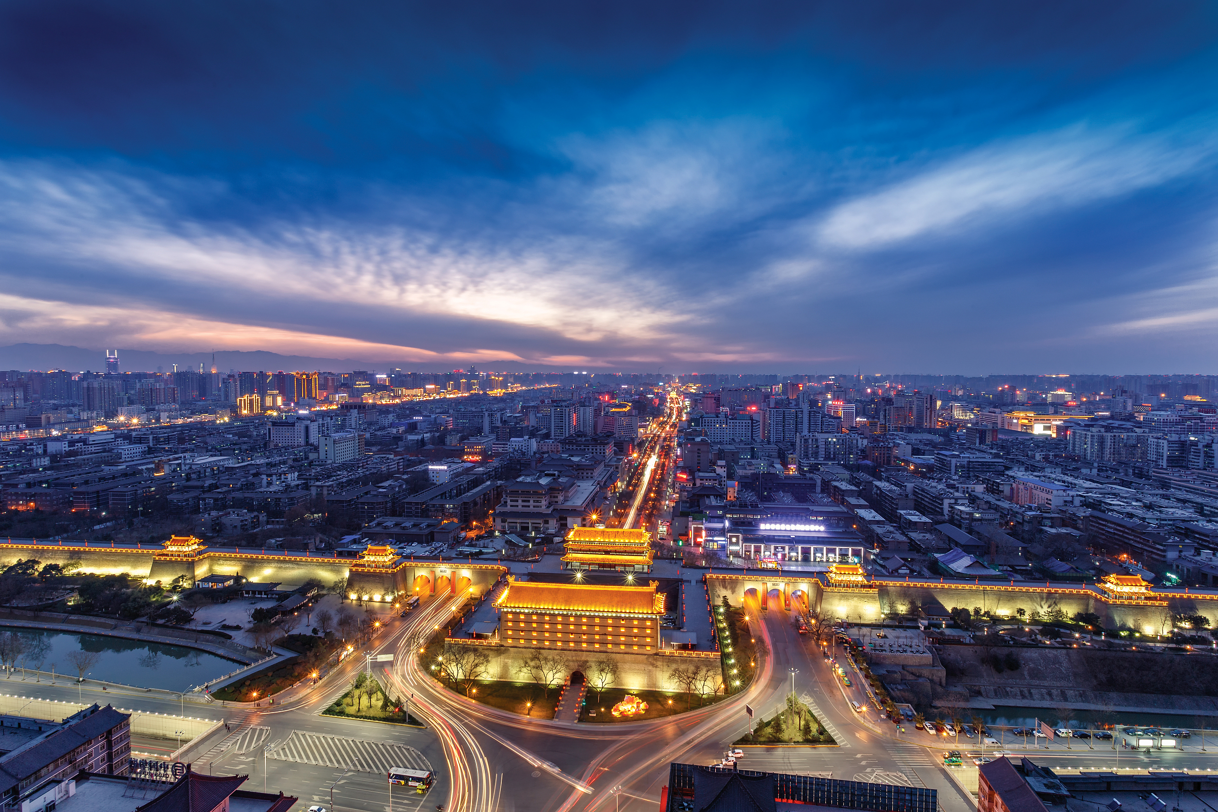
Push open the vermilion mountain gate at the foot of the Qinling Mountains, and the fantasy world from "Black Myth: Wukong" unfolds in reality. Located in Lantian, Shuilu An houses over 3,700 exquisite colored sculptures, truly living up to its reputation as "China's Second Dunhuang." After visiting, you can enjoy a Buddhist-style relaxing day~ 🚶♂️Recommended One-Day Tour: Arrive at Shuilu An (Yangxie Village, Puhua Town, Lantian County) at 9:00 AM, and plan to spend about 3 hours exploring. The colored sculptures here span from the Northern Wei to the Ming and Qing dynasties, with the most stunning being the Ming dynasty hanging sculptures. The lifelike gods and immortals are dazzling. Tips: Be sure to listen to the guided tour, or you’ll miss many detailed stories! For lunch, try the local specialties near the scenic area at a farmhouse restaurant: buckwheat noodles and spicy oil noodles, with a cost of 30-50 RMB per person for a satisfying meal. In the afternoon, visit the nearby Wangshunshan Forest Park (15 minutes by car from Shuilu An) to climb high and enjoy the Qinling mountain scenery, experiencing the meaning of "Among the famous mountains of the world, this one is uniquely marvelous." 🚗Transportation Guide: By car: About 1 hour from Xi’an city center, navigate to "Shuilu An." By bus: Take the Lantian bus from Xi’an Textile City Bus Station, then a 10-minute taxi ride from the stop. Tips: 1. Touching the sculptures inside the scenic area is prohibited; remember to turn off your phone’s flash when taking photos. 2. Wear comfortable, non-slip shoes as some areas have slippery ground. 3. Guided tours require advance booking; check the official WeChat public account for details.Serendipity_Avery_42Xi’an ancient city walls, epic pagodas, lively local streets, and a surprise snowy adventure
Here’s how to conquer Xi’an and Lantian in a week of history, food, and even some slopes action! Day 1: Arrive in Xi’an and base yourself at Xi’an Gaoxin Holiday Inn — super convenient for getting around. Day 2: 🚴♂️ Cycle or stroll Xi’an City Wall (open 8:00-22:00; addresses span four gates). Bring a windbreaker for those high sections! Day 3: Drum Tower and Muslim Quarter — go early to avoid crowds and snack on beef pancakes and pomegranate juice. Day 4: Head out to Lintong for the Terracotta Warriors No. 2 Pit (Museum open 8:30-17:00). Stay locally for easy morning access. Pro tip: Skip the gift shop, and spend time in all three pits. Day 5: Lintong Duty-Free for a little retail therapy, then transfer back to Xi’an. Day 6: Snow day! Hit Bailuyuan Yingshicheng Ski Field in Lantian (S107), easy cab or Didi from Xi’an. Rent gear onsite — just nab early morning slots for prime snow. Day 7: Big Wild Goose Pagoda (Yanta Rd, open 8:30–17:40, ¥10). Take a stroll through Qujiang Book Town for coffee + chill reads. Day 8: Zen out at Small Wild Goose Pagoda Heritage Park (No. 72 Youyi W Rd; open 9:00–17:30, closed Tuesdays). Museum is next door with neat Tang dynasty relics! Day 9: Explore Daxuexi Alley Mosque and chill in Xi’an old town before heading home. Getting Around: Xi’an Metro is your MVP, Didi for longer or out-of-town hops. Most attractions are clustered — plan routes! Eat: Muslim Quarter snacks, noodles at Lao Sun Jia (near Bell Tower), and local dumplings — try De Fa Chang. Money/Weather: It’s cashless everywhere; WeChat Pay or Alipay works best. Dec-Jan is cold, so layer up — but dry! #mytraveldiary #UNESCO #XiAn #travel #itinerary #chinaHarmoniQCloud Cliff Waterfall—The Majestic Rhythm of Liuyu Feixia
In the early morning, as you ascend the mountain path, the breathtaking sight of Liuyu Feixia's sheer cliffs and cascading waterfalls greets you. Towering peaks stand face to face, framing a deep gorge where torrents of water plunge from a hundred-foot cliff, shrouded in mist, resembling a silver ribbon suspended in mid-air. The stone path beneath your feet is damp, and the only sounds are the roaring of the waterfall and the chirping of birds, stirring your soul. Reaching the observation deck, you gaze down at the gorge, taking in the layered mountain ridges and lush green forests. Sunlight filters through the clouds, casting a glow on the waterfall, transforming it into a dazzling silver band—a masterpiece painted by nature. In that moment, the clamor of the city feels worlds away, leaving only the untamed power of the mountains and waters to remind you of life's raw and magnificent essence.Angrybird11Rebirth of Murals: Quiet Times at the Shuilu Temple Cultural Relics Management Office
#SeptemberGoodPlaces2025 Walking into the Shuilu Temple Cultural Relics Management Office in Lantian County feels like stepping into an art palace steeped in time. Within the ancient temple's profound depths, the centuries-old Shuilu paintings on the walls remain vibrant, their colors shimmering with an almost mystical luster in the soft light. A closer look at the figures reveals the beauty of meticulous brushwork in every detail, each stroke a tribute to the myriad forms of the world. Standing quietly within, the only sound is the wind rustling through the pine trees, while a deep reverence for history surges within. The faint scent of incense still lingers on the temple's wooden beams, reminding us that this is not just an art museum but a continuation of faith. The slanting afternoon sun casts a faint golden glow across the murals, as if the ancient painters are speaking to us from afar. Looking back upon leaving, the silent temple resembles an unfinished scroll of scriptures, quietly enshrining the wisdom and piety of the ancients.Angrybird11Slow Travel on the Silk Road: The Breeze and Ancient Charm of Yushan
#September2025 The Yushan Scenic Area, a slow-moving Silk Road city, resembles a slowly unfolding landscape scroll. Winding paths weave through quaint villages, where whitewashed tiles and whitewashed walls contrast with lush greenery, inviting you to slow down your pace. Along the way, you'll find traditional handmade shops, where the aroma of tea and wood blends beautifully, transporting you back to a bygone era. Climbing to the summit, the distant mountains rise in picturesque layers, and the breeze carries the scent of flowers and plants. As the setting sun paints the sky a brilliant golden orange, the entire village is bathed in a gentle glow. Yushan is more than just a traveler's stop; it embodies an attitude to life—rediscovering lost leisure in a slow-moving city, allowing your heart to align with nature and experience the calm and romance left behind by the ancient Silk Road.Angrybird11Dreamlike Glow: The Subterranean Secret of Wangchuan Cave
Descending along the winding mountain path, the entrance to Wangchuan Cave appears like a gateway to the underground. Upon entering, a refreshing coolness greets you, and the stalactites glisten under the dim yellow light, resembling stars that have fallen to earth. Every stone wall seems like the masterpiece of a sculptor, showcasing a myriad of forms, as if it were a natural art gallery. Venturing deeper, the sound of water droplets echoes faintly, like the heartbeat of the earth. Amid the interplay of light and shadow, time seems to lose its meaning, leaving only the rhythm of footsteps and breath. This dark and mysterious world holds geological wonders that span millions of years, blending reality and imagination into poetry. As you step out of the cave, the dazzling sunlight outside contrasts with the lingering tranquility of the subterranean realm within.Angrybird11The Emotions of the Cai Wenji Memorial Hall
#SeptemberGoodPlaces2025 The story of Cai Wenji is a melody that transcends millennia. Entering the memorial hall, the elegant walls are covered with her poems, each word a tearful lament. The gentle sound of the Hujia (Hujia) instrument on display echoes, as if the talented woman, bowing her head, plays "Eighteen Beats of the Hujia," recalling the pain of separation and the longing to return home. Outside the window, a swaying grove of green bamboo rustles in the wind, creating a harmonious rustling. In that moment, I seemed to sense her loneliness and resilience: a wanderer in troubled times, yet also an indomitable literary spirit. Looking back upon leaving the museum, the faint scent of ink and the lingering melodies of the instrument have long since become a tender lingering memory, a reminder that no matter how times change, true emotions can always transcend the passage of time.Angrybird11Echoes of the Ancients: A Journey Through Time and Space at the Lantian Ape-Man Site
#September2025 Stepping into the Lantian Ape-Man Site feels like being transported back to a primitive era millions of years ago. The stone artifacts displayed within the exhibition hall are simple yet exude a timeless power, each telling the story of human origins. Through the glass of the display cases, I imagine the firelight and hunting of that time, and the ancient cries echo in my ears, inspiring a deep awe. Outside, layers of loess cliffs shimmer golden in the setting sun, like the rings of time. The breeze carries the scent of earth, reminding me of humanity's kinship with the earth. Lantian is not only scientific evidence, but also a meditation on the origins of life. This silent land, like an ancient mirror, reflects our origins and awakens a sense of cherishing the present.Angrybird11The quiet scenery of the temple at night
Shuilu Temple is an ancient temple with a profound historical background in Lantian. It is located in Yangxie Village, Puhua Town, Lantian County, Xi'an City, Shaanxi Province. It is open from 09:00 to 16:30 every day. It is not as commercialized as the usual attractions, full of simplicity and tranquility, coupled with the mysterious "Black Goku" stone statue, attracting many gods and monsters fans and explorers. If you like ancient architecture or are looking for a different spot to take pictures, Suiluan is definitely worth a visit. The temple has a large number of well-preserved murals from the Ming and Qing dynasties, which are both original and artistic. Most notably, there is a stone sculpture known as "Black Goku" in the temple, a large monkey figure, legend has the meaning of guarding the temple, walking inside to feel a sense of solemnity and mystery. Recommended tour routes: It is recommended to follow the instructions from the entrance of the temple, first admire the stone lion outside the door, then slowly enter to visit the main hall, mural area. Along the way, you can pay attention to different angles to enjoy the "Black Goku" stone statue. There are different looks under different lights, suitable for taking pictures. Walking to the deepest part of the nunnery, there are some quiet corners and ancient trees where you can sit and be quiet and feel the passage of the years of the temple. Must check-in spots: 1. Black Goku Statue - Unique shape, very topical, excellent photography 2. Ming and Qing mural area - although the colors are slightly old, but the details are super beautiful, feel the historical atmosphere 3. Temple ancient trees - old trees, with the surrounding ancient environment, very suitable for slow walking, meditation Game Tips: - Recommended to arrive on weekday mornings, less crowds, photography is not easily disturbed - The air in the temple is fresh but the ground is a little sloping, it will be comfortable to wear hiking shoes or sneakers - Do not touch the murals or stone statues to keep the sights as they are - Remember to bring a small amount of water, there are no shops near the nunnery - The lights are dim in some places, remember to turn on the night mode for taking pictures Notes: - Keep quiet when entering the temple, loud noises are not recommended - Respect religious sites and do not litter - Must leave before 16:30, do not stay too long, respect the operation of the scenic spot Summary: Suilu-an is not a photo hotspot, but the atmosphere is quiet and unique, especially for those who like history and want to find some different photo spots. If you go to Lam Tin, you might as well take an afternoon to stroll around, you will be surprised. Topics: Shui Lu Temple, Lam Tin Check-in, Black Goku, Shaanxi Ancient Architecture, Temple Exploration湯米仔Wangshun Mountain in the depths of clouds and mist: Climbing high to explore the ancient past, returning to nature with your heart
#SeptemberGoodPlaces2025 Wang Shunshan National Forest Park stands quietly amidst the mountains, its vastness and grandeur palpable even from afar. The winding mountain path, flanked by lush green forests, is punctuated by the harmonious sounds of birdsong and the rustling of the wind, inviting one to let go of the worldly distractions. Reaching the mountainside, the mist drifts like a dream, and it seems as if only the mountain wind and I are in dialogue. Upon reaching the summit, the mountains before us, like a vast sea, are awe-inspiring and majestic. Even more moving is the story of Wang Shunshan's filial piety, which continues to linger in the mountains, infusing this area with warmth and faith. Perhaps the meaning of travel lies not only in admiring the scenery but also in finding a sense of resolve and peace within the soul.Angrybird11The Shifting Lights of Bailuyuan: A Journey Through Time and Folk Memories
Stepping into Bailuyuan Film City feels like opening a living scroll of history. The streets and alleys remain as they were, exuding an ancient charm through the gray bricks and tiles, as if you can hear the rhythmic gongs of opera troupes and the lively cries of market vendors. Walking through it feels like traveling back to a time when the dust had not yet settled, and nostalgia was deeply ingrained. Every courtyard and stone-paved road carries the weighty stories of the Sanqin land. I particularly enjoy sitting by the window of a teahouse, watching visitors dressed in theatrical costumes effortlessly immerse themselves in their roles, as if merging with the characters. When night falls and the lights come on, the resounding and high-pitched Qin Opera on stage vividly brings history and emotions to life. This place is not just a filming location but also a spiritual haven where one can relive the nostalgia of the past.Angrybird11Around Xi'an! 1 hour from the city center! A great city escape for summer cooling!
🏠 This courtyard homestay is really amazing! Close to Lantian Qiaomailing, it has a strong rural atmosphere, perfect for summer cooling~ Standing on the terrace looking into the distance, the morning light and the sky full of sunset clouds are incredibly healing at every moment🌅!! A short escape from the city's hustle and bustle, spending a few days here to avoid the world is really great! 🏠 The rooms are very clean, the facilities are especially new, and all kinds of amenities are complete. It is also a pet-friendly homestay, with an environment very suitable for traveling with pets🐾, allowing you to spend wonderful time with your furry friends in a peaceful setting🥳 🏠 Homestay: Luchai Mountain Ji Zhongnan Mountain Resort Homestay 🏠 Location: Mainland China / Shaanxi / Xi'an / Lantian County, Puhua Town, Xiayangzhai Village, Maojiagou No. 21AFZ. Kim 32001A Fairy Tale Hideaway Near Xi'an!
- Basic Info: Located 200 meters northwest of the Natural Garden Art Exhibition in Group 9, Yukou Village, Jiujianfang Town, Lantian County, Xi'an, Shaanxi Province, it's easily accessible 🌈. From downtown Xi'an, take the Xi-Lan Expressway or Hu-Shaan Expressway for about 1 hour to reach Lantian County, then just a 10-minute drive from the exit 🚗. - Surroundings - Natural Scenery: The homestay is nestled among mountains and rivers ⛰️, surrounded by lush greenery 🌳. In front lies a vast sea of buckwheat flowers 🌼, turning golden during bloom. When the breeze blows, the flower field sways like a fairy tale world 🧚♀️. - Cultural Attractions: Nearby sites include the Lantian Ape-Man Ruins 🏺, Wangshun Mountain National Forest Park ⛲, Jiujianfang's Thousand-Acre Lotus Pond 🪷, the "Three Rivers and One Mountain" Lantian section, and Shuilu Temple, blending natural beauty with cultural charm ✨. - Homestay Facilities - Entertainment: Features a heated pool 🏊♀️, slides 🛝, swings 🎪, trampolines for kids, plus KTV 🎤, meeting rooms 📋, mahjong tables 🀄, and BBQ areas 🍢—perfect for family trips 👨👩👧👦, friend gatherings, or business trips 💼. - Guest Rooms: 12 rooms in total, including scenic suites with terraces and private hot springs ♨️. Wood-toned architecture and minimalist interiors with large floor-to-ceiling windows ensure great views from every room 🪟. - Dining: Offers hotpot 🍲, BBQ 🍖, stir-fries, and more, with fresh ingredients. Sichuan hotpot and specialty BBQ are highly recommended. Also has a café ☕ and afternoon tea area 🍰.Olivia Simmons Olivia)70Treasure Spot for Family Fun Around Xi'an: Gedacun Village
Hidden Gem for Family Outings ❥ Gedacun Village near Xi'an A perfect place to let kids play in the sand all day Stumbled upon Gedacun Village by chance This homestay has a sandpit—so we set off without hesitation Turned out to be an absolute treasure trove! The village is small but offers sandpits and a restaurant at the homestay There’s also a campsite where you can rent canopies ☕ Café 📚 Bookstore 🏺 Pottery Studio Kids can fish, and there’s a large lawn for running around Everything is within walking distance, with lush trees providing shade Best of all, it’s not crowded—even on weekends No jostling like at many other campsites Kids have fun, parents relax Plus, it’s super photogenic—a triple win! Just a 5-minute drive from White Deer Plain Film Studio If time allows, you can visit both spots A fantastic outdoor destination in Xi'an Ideal for holiday family outings Perfect for letting kids explore nature 👉 General's Hometown · Gedacun Boutique Homestay_TI***lmXi'an Lantian! A Charming Countryside Villa! Perfect Summer Escape in the Off-Season!
🏘️ Room Type/Layout: This homestay boasts an excellent location in a quaint village of Lantian County, nestled between the Qinling Mountains to the south and the White Deer Plain to the west. Far from the city's hustle and bustle, you'll wake up to lush forests outside your window—a true hidden paradise! The rooms are stylishly designed, featuring floor-to-ceiling windows that frame the verdant woods. The fresh air and serene surroundings instantly immerse you in nature's embrace, offering ultimate relaxation. Kids will love the sandpit, swings, treehouse, and tent lawn—a dream playground! Adults aren't left out either, with evening stargazing KTV sessions, BBQ feasts, and group sing-alongs for unforgettable fun. Fully equipped with amenities, you can explore the area on the homestay's bicycles—a perfect way to unwind. Service is impeccable, with friendly staff ensuring a swift check-in and detailed introductions to the property. Address: Xiafuyu, Group 7, Jiangjun Village, Qianwei Town, Lantian County, Xi'an (700m north of White Deer Plain Film and TV City) Homestay: General's Hometown · Gedacun Boutique HomestayCharlotte Lee44 Bliss

Popular Lantian topics

2025 Recommended Guides in Lantian (Updated October)
123 posts

2025 Recommended Attraction in Lantian (Updated October)
111 posts
2025 Recommended Homestays in Lantian (Updated October)
37 posts

Destinations related to Lantian
2025 Xi'an Travel Guide: Must-see attractions, popular food, hotels, transportation routes (updated in October)
6181 posts

2025 Yuncheng Travel Guide: Must-see attractions, popular food, hotels, transportation routes (updated in October)
195 posts
2025 Mount Hua Travel Guide: Must-see attractions, popular food, hotels, transportation routes (updated in October)
33 posts
- 1
- 2
- 3
- 4
- 6
Post
More recommendations
Popular Trip Moments
How to Enjoy Xi'an's Mountains and Rivers | Best Route for Maple Viewing in Lantian | Attend a Millennium Appointment with the Black Wukong at Shuilu An | Cloud Cliff Waterfall—The Majestic Rhythm of Liuyu Feixia | Rebirth of Murals: Quiet Times at the Shuilu Temple Cultural Relics Management Office | Dreamlike Glow: The Subterranean Secret of Wangchuan Cave | Wangshun Mountain in the depths of clouds and mist: Climbing high to explore the ancient past, returning to nature with your heart | The Shifting Lights of Bailuyuan: A Journey Through Time and Folk Memories | Around Xi'an! 1 hour from the city center! A great city escape for summer cooling! | A Fairy Tale Hideaway Near Xi'an! | Xi’an ancient city walls, epic pagodas, lively local streets, and a surprise snowy adventure | Slow Travel on the Silk Road: The Breeze and Ancient Charm of Yushan | The Emotions of the Cai Wenji Memorial Hall | Echoes of the Ancients: A Journey Through Time and Space at the Lantian Ape-Man Site | The quiet scenery of the temple at night | Treasure Spot for Family Fun Around Xi'an: Gedacun Village | Xi'an Lantian! A Charming Countryside Villa! Perfect Summer Escape in the Off-Season! | Peach Blossom Luck Treasure Homestay | Wangchuan Cave Adventure Guide: Have Fun Without Spending Money | 1h direct access to Summer Garden from Xi'an | Xi'an Bailuyuan, one hour... chilling on the top of the mountain~ | Stay at this beautiful, uncrowded vacation homestay in Lantian | You absolutely HAVE to check out Xi'an's new riverside campsite! | I love flowers and plants in spring! I love having tea around Xi'an. | When exploring places to visit around Xi'an, this hidden gem of a homestay is perfect for gatherings | Wangshun Mountain Forest Park, Lantian | "Little Huangshan" in the Qinling Mountains | Xi'an Shuilusi Temple: A Millennium of Dialogue Through Clay Sculptures | Lantian Lingyun Cave | A Masterpiece of Nature | Lantian Gepai Ancient Town|Explore the Ancient Town | Shuilu'an Temple | A Niche Must-See Attraction in Xi'an
Recommended Attractions at Popular Destinations
Popular Attractions in Bangkok | Popular Attractions in Kuala Lumpur | Popular Attractions in Dubai | Popular Attractions in Chefchaouene | Popular Attractions in Kyoto | Popular Attractions in Los Angeles | Popular Attractions in Bali | Popular Attractions in Shanghai | Popular Attractions in Iguazu National Park(Argentina) | Popular Attractions in New York | Popular Attractions in Paris | Popular Attractions in Walt Disney World Resort | Popular Attractions in Melbourne | Popular Attractions in London | Popular Attractions in Singapore | Popular Attractions in Beijing | Popular Attractions in Las Vegas | Popular Attractions in Rome | Popular Attractions in Zanzibar Island | Popular Attractions in Sydney | Popular Attractions in West Lake | Popular Attractions in Osaka | Popular Attractions in Tokyo | Popular Attractions in Phuket | Popular Attractions in Barcelona | Popular Attractions in Madrid | Popular Attractions in Chengdu | Popular Attractions in Florence | Popular Attractions in Istanbul | Popular Attractions in Jungfrau Region
Popular Restaurants in Lantian
Duxiuxiaochicheng | 蓝田九大碗民俗食府(蓝新村居民小区店) | 山水玉舍(蓝田店) | KEN DE JI LAN XIN DIAN | 茂盛小吃 | 山飨茶饭·Café | 方若·桃花源度假村落民宿·山食十八道餐厅(蓝田店) | 聚义楼酒楼 | 刘家真传油糕 | 赵九记呱呱老火锅(蓝田店) | 垚森食水记 | 王家大院民宿餐饮 | Malayouhuo (beihuanlu) | 华莱士·全鸡汉堡(蓝新路店) | 老段家牛羊肉泡馍(蓝田店) | 岐蓝特擀面皮(蓝新路店) | 李家院子 | 岐蓝特擀面皮(北环路店) | 锦园鲜菜火锅(北环路东段店) | 汤峪湖森林公园沪森农家小院 | 滋水驿 | YONG FU LOU | Shengyunzizhushuankao (lantian) | Yaojiazhutifang (lantianxian) | Shengribingwu | Maidesike (lantian) | 鑫龙门御羊宫(蓝田店) | 石艺园农家乐 | 邓家饺子馆 | 渝尚鱻纸包鱼(蓝田总店)
Popular Ranked Lists
Popular Best Things to Do in Emeishan | Popular Best Things to Do in Fuyang | Top 50 Must-Visit Restaurants in Munich | Popular Best Things to Do in Kunshan | Top 20 Best Things to Do in Ottawa | Top 50 Must-Visit Restaurants in Bruges | Top 50 Luxury Hotels near Klagenfurt | Top 50 Best Things to Do in Frankfurt | Popular Best Things to Do in Wuyi | Popular Premium Hotels in Bowness-on-Windermere | Top 10 Luxury Hotels near Bac Giang | Popular Best Things to Do in Lanxi | Top 50 Must-Visit Restaurants in Madrid | Popular Premium Hotels in Mito | Top 50 Must-Visit Restaurants in Songyang | Popular Premium Hotels in Nakhon Pathom Province | Top 10 Best Things to Do in Malé | Top 50 Must-Visit Restaurants in Milan | Top 50 Must-Visit Restaurants in Sapporo | Popular Premium Hotels in Gwynedd | Top 50 Must-Visit Restaurants in Athens | Top 50 Luxury Hotels near Innsbruck | Top 10 Best Things to Do in Xianyang | Popular Premium Hotels in Arrowtown | Top 10 Best Things to Do in Vientiane | Top 50 Luxury Hotels near Songkhla | Top 50 Must-Visit Restaurants in Chaozhou | Top 50 Luxury Hotels near Choshi | Popular Premium Hotels in Suffolk Park | Top 50 Must-Visit Restaurants in Ningbo
About
Payment methods
Our partners
Copyright © 2025 Trip.com Travel Singapore Pte. Ltd. All rights reserved
Site Operator: Trip.com Travel Singapore Pte. Ltd.
Site Operator: Trip.com Travel Singapore Pte. Ltd.