App
Customer Support
NZD
Find Bookings


1 / 4


Mentioned in This Moment
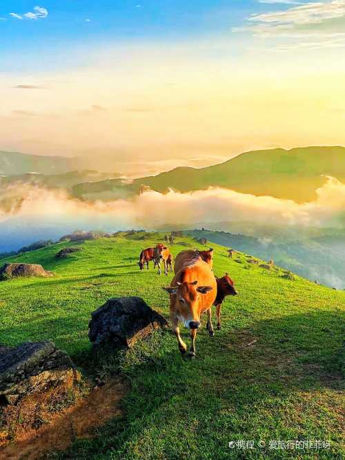
5/52 reviews | Mountain climbing
Fangchenggang
View
Show More
Popular Trip Moments
A Must-Read Travel Guide for Friends Visiting Fangchenggang | 7 Days Exploring Baise, Chongzuo, and Fangchenggang: Your Ultimate Guide | This isn't a foreign country, it's Wangzhouding in Fangchenggang, Guangxi. | Welcoming Hotel: Lanquan Hotel (Fangchenggang Shangsi National Middle School Branch) | A secluded paradise hidden in the mountains | On the Border of Guangxi, Discover a Singing Beach | [Xiaotong's Homestay] Recommended Homestay for the March 3rd Festival/Weekend Trip to Fangchenggang | A Hiker's Paradise: Switzerland in the Clouds | Fangchenggang: A Seriously Underrated Coastal Gem, Where Beauty Meets Tranquility | First-Time Tide Pooling Experience, Seafood Lover's Dream, "Little Vietnam" Fangchenggang | Highly recommend Guangxi's hiking paradise, Fangchenggang. | After three days of traveling in Fangchenggang, my consumption concept collapsed | A Short Holiday Trip to Vietnam: An Amazing Travel Experience | Dongxing | A Very Pleasant Seaside B&B | Fangchenggang-Baise-Chongzuo 5-Day Tour: Explore the Beauty of Guangxi | The seaside on a cloudy day offers a unique atmosphere and experience. | Fangchenggang Wangzhouding + Guangzhou Flower Sea | A Stunning Nature Tour! | Discover a Natural Hot Spring Wonderland and Embark on the Ultimate Healing Journey! | This Fangchenggang hotel is my go-to! Unforgettable stays from just ¥100 per person! | Discover the breathtaking beauty of Paradise Beach in Fangchenggang, Guangxi! | Exploring Jiulongzhai in Fangchenggang, Guangxi: A Hidden Border Paradise | Baisha Bay in Fangchenggang, Guangxi: Where golden sands meet azure waters | A guide to Fangchenggang, Guangxi, during the Lunar New Year off-season! | Explore the Wild Man Valley in Fangchenggang, Guangxi, and Discover a Mysterious Tribe! | Jiulongtan Rafting: Get Ready for an Amazing Time! | Discover the Jiangshan Peninsula in Fangchenggang, Guangxi: Stunning scenery awaits! | Exploring the Shiwandashan Mountains in Guangxi's Fangchenggang: A Hidden Natural Wonder! | Explore Fangchenggang, Guangxi: A Magical Journey to the Strange Stone Beach | If you only have one day in Fangchenggang, just follow this stunning itinerary! | A sacred place of compassion written in sculpture
Popular Travel Types
Recommended Attractions at Popular Destinations
Bangkok attraction near me | Manila attraction near me | Tokyo attraction near me | Taipei attraction near me | Hong Kong attraction near me | Seoul attraction near me | Kuala Lumpur attraction near me | Los Angeles attraction near me | Shanghai attraction near me | New York attraction near me | Shenzhen attraction near me | Osaka attraction near me | Singapore attraction near me | London attraction near me | Guangzhou attraction near me | San Francisco attraction near me | Beijing attraction near me | Macau attraction near me | Bali attraction near me | Jakarta attraction near me | Paris attraction near me | Ho Chi Minh City attraction near me | Istanbul attraction near me | Phuket attraction near me | Chicago attraction near me | Seattle attraction near me | Toronto attraction near me | Orlando attraction near me | Cebu attraction near me | Chiang Mai attraction near me
Popular Attractions
Harbin Sightseeing Cableway | Shanghai Maglev Train | The National Museum of Malaysia | Impression Wulong A Large-Scale Realistic Performance | The West Lake | Punting On The Avon (Antigua Boat Sheds) | Old Town of Lijiang | Wings of Time Fireworks Symphony | Tongli Town | Three Gorges Museum | Dazu Rock Carving | Yilong Lake | Xi'an Bell Tower | Zhongjie Commercial Circle | Jiaoshan | Tay Ho Sports Complex | Xiao Qing Dao | Lu Xun Park | Shotover Jet Queenstown | Museum of History and Holocaust Education | Parco Vecchio Mulino | Les cinémas de Cavaillon | Mullins Soccer Complex | Templo Nuestra Señora de los Remedios | Blessed 8 Resort | Mandra Durga Mandap দুর্গাপূজা মন্ডপ | Rumskulla Aok | Nhlabane | Kingdom Hall of Jehovah's Witnesses | Jayalath Cinema
Popular Restaurants in Fangchenggang
花池与洛咖 | 防城港荣兴格朗大酒店·格朗东南亚餐厅 | 16%cafe | 东兴JX酒店·心越-越南餐厅 | 防城港佰逸国际酒店·梅里西餐厅 | 麻屋手抓海鲜(防城港总店) | GANG CHEN GUO JI DA JIU DIAN BAO LAI XI CAN TING | FU GE DA PAI DANG | 必胜客(恒富店) | 御鑫记猪肚鸡 | HUA JIE JI FEN DIAN | 港宸国际大酒店中餐厅 | 明翠炒螺店(教育路店) | 一凤鸡饭 | CHUAN DOU JIU LOU | 海迎门京族文化度假村 | 十八子(振兴街店) | 甜言蜜语 | 莱茵河畔 | YANG XIAO XIAN | SHEN JING SHAO E QI SHA DIAN | YUE LAI YUE XIANG YUAN WEI YUE NA JI ROU FEN | 壹街石锅烤肉 | YI XIAN LUO SHI FEN | 雄记中越饭店(口岸店) | 精华味语(港口店) | DA WANG YUE YUE SHI FENG WEI CAN TING | YUE NA JI FEN ZHONG XIN DIAN | HE DIE LIU YANG ZHENG CAI | LIU LIAN PIAO XIANG GANG KOU DIAN
Popular Ranked Lists
Popular Local Restaurants in Huanggang | Top 10 Local Restaurants in Tengchong | Top 9 Local Restaurants in Kumamoto | Popular Luxury Hotels Near Akhaltsikhe | Popular Premium Hotels in Palakkad | Top 4 Best Things to Do in Hornafjordur | Popular Premium Hotels in Durango | Popular Best Things to Do in Dauphin County | Top 19 Local Restaurants in Shaoxing | Top 9 Local Restaurants in Lushan | Popular Best Things to Do in Monterey | Top 10 Local Restaurants in The Rocks | Popular Luxury Hotels Near Boljoon | Top 8 Local Restaurants in Burqin | Popular Best Things to Do in Koyaki | Top 3 Best Things to Do in Mangya | Popular Premium Hotels in Korcula | Top 20 Local Restaurants in Nanchang | Popular Luxury Hotels Near Palakkad | Top 6 Local Restaurants in Zhangzhou | Popular Luxury Hotels Near Phuc Yen | Popular Premium Hotels in Torquay | Popular Best Things to Do in Zhong County | Popular Premium Hotels in Port Harcourt | Top 10 Local Restaurants in Shanwei | Popular Premium Hotels in Maguan | Popular Luxury Hotels Near Grad Korcula | Top 10 Local Restaurants in Jiangmen | Top 8 Best Things to Do in Dallas County | Popular Best Things to Do in Milwaukee County
Payment Methods
Our Partners
Copyright © 2025 Trip.com Travel Singapore Pte. Ltd. All rights reserved
Site Operator: Trip.com Travel Singapore Pte. Ltd.
Site Operator: Trip.com Travel Singapore Pte. Ltd.