OverviewBookNearbyReviewsWin PrizesRecommended
Share to
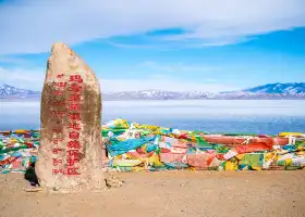
Kangrinpoche
岡仁波齊6.4
192 Reviews
 based on 199 reviews
Open Opens at 09:00-21:00
Recommended sightseeing time:1-2 days
Address:
Puland County, Ali DistrictMap
Phone4006666712
What travelers say:
The ticket was issued very quickly, the scenery of Gang Rinpoqi was very beautiful, we completed the mountain on foot 54 kilometers, very meaningful, the scenic service attitude is very good, the facilities are perfect, the recommended seat sightseeing car is a few kilometers away, very comfortable
More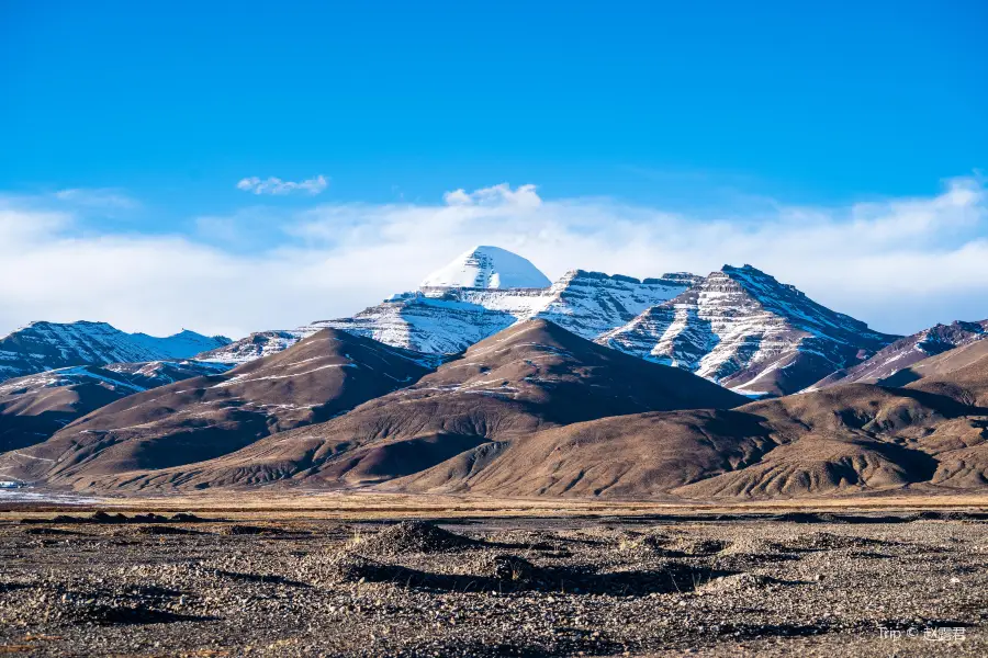
See all 54 photos
Saved by 14
Kangrinpoche Highlights: Must-See Features and Attractions
Some information may have been translated by Google Translate
Kangrinpoche is the main peak of Mount Kailash. It is in Baga Village, Northern Pulan County, Ali. The sacred mountain is well known across the world and is a world center for Hinduism, Tibetan Buddhism, Bon Religion and Jaina. Legend has it that when you walk around the mountain, you can atone for your sins. As a result, plenty of followers come to the mountain for pilgrimages every year.
Recommendations Near Kangrinpoche
Kangrinpoche Reviews: Insider Insights and Visitor Experiences
Some reviews may have been translated by Google TranslateWrite a Review
 (192 Reviews)Trip.com
 (199 Reviews)TripAdvisor
/5
Outstanding ReviewsAll (192)
Latest
With Photos (82)
Verified Booking (33)
Positive Reviews (184)
Negative Reviews (4)
- 1
- 2
- 3
- 4
- 39
Kangrinpoche Photos: Trip Moments
 Tibet Ali, the journey of the sacred mountain and lakeTibet Ali, the journey of the sacred mountain and lake Mount Kailash, Lake Manasarovar, the ancient city of Guge, Tholing Monastery Just mentioning these shining names makes one's heart surge Mount Kailash is a sacred mountain shared by Buddhism, Bon, and Hinduism Lake Manasarovar is one of the three major sacred lakes in Tibet The ancient city of Guge was the capital of the Guge dynasty, once very prosperous, and suddenly destroyed in the 17th centuryDiscoveringDaze
 The Potala Palace in TibetThere are many benefits to going to Tibet Benefit One: Off-peak, fewer people and beautiful scenery Compared to the crowded summer holidays, there are fewer people in Tibet in winter, and the scenery is more pure. Even in temples like the Jokhang Temple and the Potala Palace that have a smaller capacity, what you see more are Tibetans who bow their heads and turn the scriptures for pilgrimage, rather than noisy tourists. Benefit Two: Good climate, warm sun In winter, more than 80% of Tibet is sunny, and occasional snow is just a while. Compared to the scorching sun in summer, the winter sun is warm and bright, very comfortable. Benefit Three: Save money Half-price tickets are trivial, the key is the prices of air tickets, accommodation, and chartered cars, all are cheaper, and you can stay in better hotels at the same price! Benefit Four: Encounter the golden mountain Almost every day in winter is sunny, and the Namjagbarwa Peak, which is usually not encountered by 9 out of 10 people, has a 97.5% chance of seeing her sunrise golden mountain in winter, as well as the sunrise golden mountain of Gang Rinpoche and the sunrise golden mountain of Mount Everest. Benefit Five: Go to see the blue ice Many lakes in Tibet will freeze in winter, and because the water quality is super good, many lakes will produce blue ice cracks after freezing, which cannot be seen in other seasons. If the lake is frozen solid, you can also walk on the lake Benefit Six: Ultimate starry sky The Namtso in winter is frozen for thousands of miles, the sky is clear at an altitude of 4700m, and the open lake can see the very clear Milky Way with the naked eye, which is the best choice for photography enthusiasts. Benefit Seven: Cultural experience, Tibetan New Year The Tibetan New Year and the Han New Year are not at the same time, and the Tibetan New Year in the Nyingchi area, Lhasa area and Shigatse area will also be different, usually around 1-2 months before and after the New Year, The activities of the Tibetan New Year are rich, and if you happen to catch up, you can also experience the strong Tibetan New Year flavor. (。・ω・。)ノ♡ Youth has no price, one stop to Lhasalumina_5568
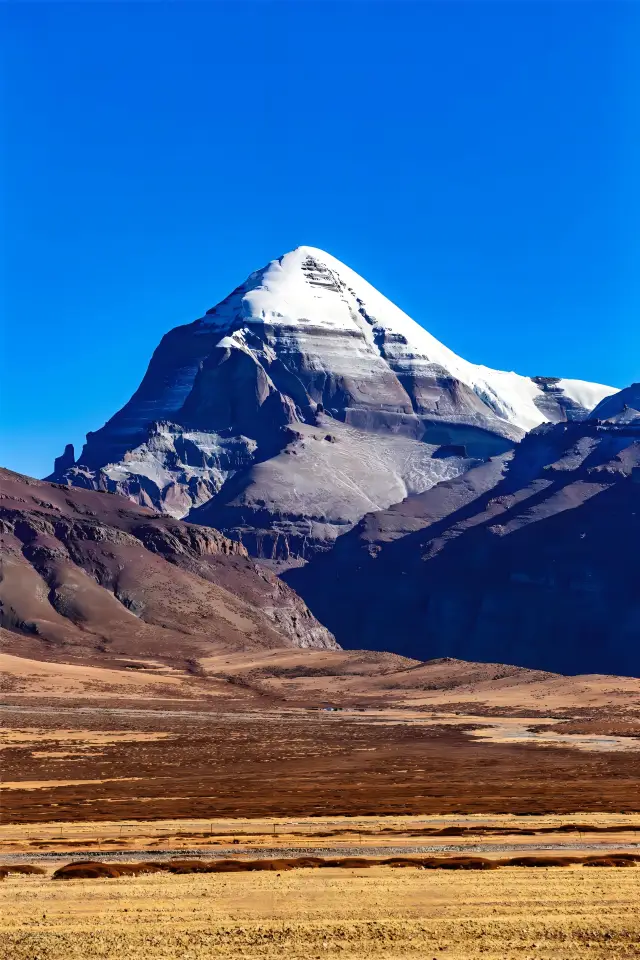
 Mount Kailash, an eternal snow-capped mountain, is a sacred place in the hearts of the Tibetan peopleAt the roof of the world, there stands a mountain peak against the sky, and that is the holy Mount Kailash. Its snow-clad summit glistens in the sunlight, resembling a colossal crystal throne, bearing the hopes and dreams of all beings. Mount Kailash is considered a sacred mountain in several religions, including Hinduism, Tibetan Buddhism, Bon, and ancient Jainism. It is regarded as the center of the world and in Buddhism, it is the spiritual practice site of Buddha Shakyamuni.WanderlustWarrior++
 Mount Kailash stands as a sacred mountain, a holy source for both Buddhism and BonIn the heart of Tibet, China, stands the roof of the world - Mount Kailash. It is steep and solemn, like a supreme emperor, standing under the sky, ruling all things. When I set foot on the land of Mount Kailash, it seemed as if time stood still, and my soul was deeply shocked by this sacred mountain. It stands on the top of the mountains, majestic and solemn, wrapped in clouds, like a staircase to heaven. As I slowly climbed to the top of the mountain, I saw devout prayers everywhere. They were in awe, bowing their heads and clasping their hands in tribute to the sacred mountain. I saw them enduring the cold, braving the storm, moving forward step by step. They believed that Mount Kailash was blessing them, protecting their souls. The temple at the top of the mountain is solemn and ancient, silently bearing the awe of countless pilgrims. Here, I seemed to travel through time and space, entering a mysterious and sacred world. The bell sound is long and lingering, echoing between the valleys, sending the sacred prayers to heaven. Standing on the top of the mountain, I looked up at the blue sky, feeling the tranquility and peace that Mount Kailash brought to me, and inspiration surged in my heart. In this towering place, my heart seemed to have transcended the mundane. Mount Kailash is a poetic mountain, every inch of land exudes a mysterious and unique beauty. The scenery of the sacred mountain is never the same, it is a unique work of art bestowed by heaven. It is a masterpiece of nature, an extraordinary painting, intoxicating people in beauty and magic. At the foot of Mount Kailash, I walked along the foothills, exploring the wonderfulness that this pure land brought to me. Under the blue sky, the lush wooden houses exude a primitive atmosphere, the flowers sway in the breeze, and the fresh fragrance floats in the air, like a praise to life. The lake is as calm as a mirror, reflecting the magnificent mountains around, making people feel emotional. The green grass extends to the horizon, and the goats are leisurely eating grass. They are the masters of this land, free and comfortable. Here, time is so slow, as if it has stopped. I sat by the lake, gazing into the distance, immersed in beauty and tranquility. There is no hustle and bustle here, only inner peace. The sun in Mount Kailash is so bright, warm and loving. It illuminates the earth and also illuminates the soul. Here, I felt the clarity and brightness of my heart, warmed by the blessing of Mount Kailash. I walked along the valley, strolling at the foot of Mount Kailash, feeling the pulse of the earth. The people here are simple and cheerful, they step on the top of the mountain with solid steps, striving towards the sacred goal. They believe that as long as they are devout, Mount Kailash will always protect them. Mount Kailash is a spiritual pilgrimage. Here, my heart is cleansed, purified, and I understand the truth of life. Although the journey is short, it has given me enlightenment for a lifetime.diplomatical.leona
 Only those who have been to Ali have been to Tibet|Ali North Line Strategy Sharing|Ali North Line Strategy Sharing. Without Ali, there is no Tibet, if you haven't been to the Ali region, it's like you haven't been to Tibet❗Only by walking it yourself, you will know what is the essence of Tibet!👏 · 🔸The routes in the Ali region are mainly divided into: Big North Line, Middle North Line, Small North Line and South Line according to the difficulty level · 🈯Today we will focus on the itinerary and strategy of the Small North Line~👋 ✨Travel time: Nine days and eight nights ✨Best travel season in Tibet: May to October · 💫Itinerary overview: Depart from Lhasa, via Shigatse, Coqen County, Wenbunancun, Nima takes 5-7 days.👋To Bangor County, then return to Lhasa via Namtso,✌you can take in the sights of Dajiacuo, Zarinnamucuo, Selincuo, Namtso, Dazecuo, Qia Guicuo along the way.👀 · 💫Highlights of the Small North Line: Cross the uninhabited area, one lake after another, Salongda+hang prayer flags, experience the essence of Tibet · 💫Detailed route: D1: Lhasa-Yang Lake-Karola Glacier-Manla Reservoir-Shigatse D2: Shigatse-Tashilhunpo Monastery-Jiaula Mountain Pass-Jiacuo La Mountain Pass-Rongbuc Monastery-Everest D3: Everest Base Camp-Shishapangma Peak-Peiku Lake-Zhongba-Payang D4: Payang-Maquan River Wetland Park-Gongzhu Lake-Zhada Earth Forest-Guge Dynasty-Taqin D5: Taqin-Mount Kailash-Manasarovar Lake-Namunani Peak-Laang Lake-Zhongba-Saga D6: Saga-Dagjia Fountain-Dajiacuo-Garongcuo-Palacuo-Coqen D7: Coqen-Zarinnamucuo-Dangreyongcuo-Wenbu Village-Dangqiongcuo-Nima D8: Nima-Dazecuo-Qia Guicuo-Selincuo-Cuoe Lake-Bangor D9: Bangor-South Bank of Namtso-Nagenla Mountain Pass-Nyenchen Tanglha Mountain-Lhasa · ✨Highlights: 🎈Three Sacred Lakes: Yang Lake, Namtso, Manasarovar Lake 🎈World's highest peak: Mount Everest 🎈Tibet's highest sacred mountain: Mount Kailash 🎈Land glacier: Karola Glacier 🎈Uninhabited area: Crossing the Qiangtang uninhabited area 🎈Civilization that disappeared overnight: Guge Dynasty · ⚠Things to know before entering Tibet Don't worry too much about altitude sickness before entering Tibet, your mindset determines the satisfaction of the trip! ·Lucy.Moore@32
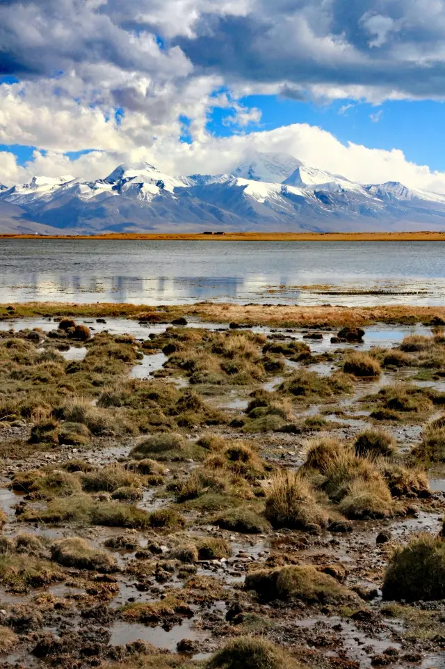
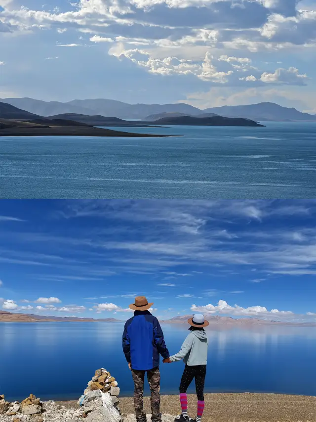
 The secret land of Western Tibet, Ali in the sky, Ali 2Ali, is the Tibet of Tibet. It's on the distant horizon, and also close to the soul. It is the 'most unique paradise in China', but only the brave have the chance to see the most magnificent scenery on this road. Here is the world-class sacred mountain - Gang Rinpoche The greatest wish of a Buddhist in his life is to go to Gang Rinpoche for a pilgrimage. Some people say that even if they die on the way, it's happy, because the soul will rise to heaven. Here is the 'Tibetan sacred lake' - Mapang Yongcuo, 'Ghost Lake' - Lhanag-tso If Gang Rinpoche is a towering man, then Mapang Yongcuo is a fairy-like goddess. Quiet, holy, captivating, its temperament is enough to dissolve all the irritability in the world. Next to the 'sacred lake' Mapang Yongcuo, is the so-called 'Ghost Lake' Lhanag-tso. The lake is so blue that it intoxicates people, the dark red hills by the lake, the color is hazy, the vast lake area does not see a person or livestock, it is so empty as if standing on the edge of the universe. A narrow mountain separates the 'sacred lake' and the 'ghost lake', the sacred lake and the ghost lake are also gently undulating in a gentle breeze, without showing off or sadness, only the companionship of thousands of years.NomadicWonderer
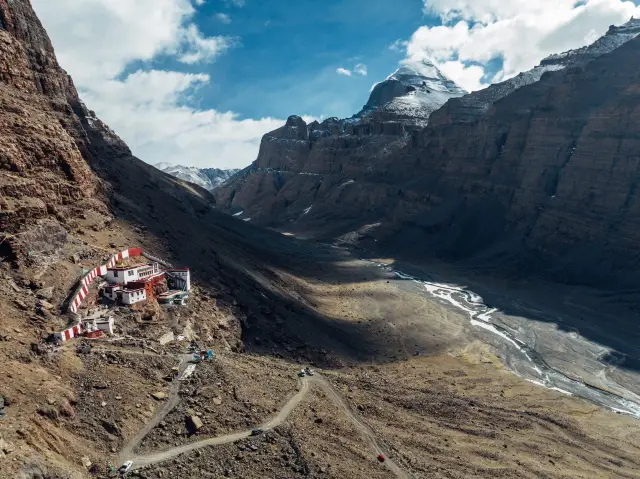
 Mount Kailash Pilgrimage Guide, Personally Tested Effective EditionMount Kailash Pilgrimage Guide Mount Kailash. In Tibetan, it means 'Mountain of the Gods,' and in Indian Sanskrit, it means 'Paradise of Shiva' (Shiva being a principal deity in Hinduism), and it is also the birthplace of the indigenous Tibetan religion—Bön. Moreover, Mount Kailash is a sacred mountain revered by the four major religions: Tibetan Buddhism, Bön, Hinduism, and ancient Jainism. Every year, countless people come here to circumambulate the mountain. Circumambulation is not only a physical journey of hardship but also a spiritual wandering. The difficulty of Mount Kailash lies in its high altitude; the entire route is basically above 4,600 meters, and one must cross a pass that is over 5,600 meters. If one is well-adapted to high altitude sickness, the difficulty of the pilgrimage is not great, and it is a site where everyone can go on a pilgrimage. In short, the main issues one faces when circumambulating Mount Kailash in Tibet's Ali region are: high altitude and fatigue. 'High' refers to the high altitude. Tibet is known as the 'Roof of the World,' and Ali is called the 'Roof of the Roof of the World.' During the circumambulation, there are few accommodations below 4,500 meters in altitude; Saga, Tarqin, and Darchen are all above 4,500 meters. The high altitude is a huge challenge for most people. 'Fatigue' refers to the starting point of the circumambulation, Tarqin, which is around 4,600 meters in altitude, the first day's rest stop at Darchen is 5,200 meters, and the highest point, Drolma La Pass, is 5,600 meters. During the two days of trekking, the altitude difference exceeds 1,000 meters. The significant altitude difference and the 54-kilometer trekking distance require a certain level of physical fitness from the pilgrims. Additionally, due to the limited accommodation points, the intensity of the trek is unevenly distributed. Best time: May to October (August to September is optimal) Total route length: 52km Accommodation: For a two-day trek, choose to stay at Darchen or the Sky Burial Platform; those with ample energy can cross Drolma La Pass and stay at the immovable tent pegs. Supplies: Tarqin—Sky Burial Platform, immovable tent pegs—Tarqin, there are shops along the way selling water, snacks, instant noodles, and portable oxygen bottles. There are no supply points from the Sky Burial Platform to Drolma La Pass to the immovable tent pegs. Rescue vehicle route in the scenic area: Tarqin—Darchen, immovable tent pegs—Tarqin, costs vary from 800 to 1200. Equipment list 1. Mountaineering or trekking shoes: High-top and waterproof required 2. Backpack: 30L should be enough, with a professional carrying system. Whether you hire a porter or not, remember to carry your own road meals, drinking water, and warm clothing 3. Waterproof jacket and pants, down jacket, quick-dry underwear, hat, headscarf, gloves, wool socks, gaiters, dirt-proof sleeping bag 4. Trekking poles, power bank (accommodation may have power outages) 5. Medicines, glucose, cold medicine, injury treatment, etc. Precautions: The descent from Drolma La Pass is steep and slippery, with icy and snowy road surfaces at the foot of the slope. There are marmots along the way; please do not approach them closely (they may carry the plague virus).Oscar~Brooks
 The most mysterious mountain in the world remains unclimbed to this dayThere was once a documentary called 'Gang Rinpoche', which revolves around a sacred and mysterious mountain. People have left their time, emotions, stories, and lives here. Gang Rinpoche is an existence more sacred than life itself in the hearts of the Tibetan people. I have long heard of many mysterious events associated with Gang Rinpoche, such as it being the center of the world, the prominent swastika symbol on the mountain, the mysterious caves on the mountain that no one has yet glimpsed, the pyramid-like shape of the mountain, and many legends related to yetis, wild men, long-haired monsters, and even extraterrestrials. Tibet is already a mysterious place, so high, so far, so cold, so quiet. Not to mention this mountain peak that is even higher, farther, colder, and quieter... I am willing to believe everything about Gang Rinpoche, even the legends. Travel Information: Gang Rinpoche is the main peak of the Gangdise Mountains, the highest peak in the western section of the range that traverses between the northern Kunlun Mountains and the southern Himalayas. It is one of the four sacred mountains of Tibetan Buddhism and is recognized as the 'center of the world' by Hinduism, Tibetan Buddhism, the indigenous Bon religion of Tibet, and the ancient Jainism. Gang Rinpoche has an elevation of 6,714 meters and is composed of Neogene conglomerate. It is a steep, conical 'pyramid-shaped' mountain. Gang Rinpoche has been selected by 'China National Geographic' magazine as one of the top ten most beautiful mountains in China. Gang Rinpoche has symmetrical walls, with the more famous landmark on the south side: a huge ice chute that descends vertically from the summit and a horizontal rock layer that forms the Buddhist swastika symbol. Gang Rinpoche has always been a place of longing for pilgrims and explorers, but no one has yet been able to climb this sacred mountain, or perhaps no one dares to offend the center of the world. It is recommended to visit the Potala Palace and Jokhang Temple in Lhasa, or the Yamdrok Lake, Namtso Lake, Tashilhunpo Monastery around Lhasa, and the Nyingchi region. If time permits, it is best to take a look at Gang Rinpoche along the route of the Everest Base Camp.OliviaMcPhee27
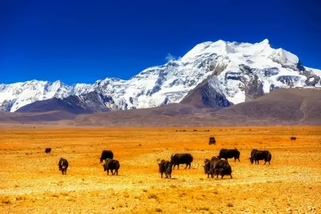
 Welcome to Ali! To the west of Tibet, the essence of the Tibetan Plateau!In this area, which occupies nearly a quarter of the area of Tibet and is the most remote and desolate region of the entire Tibetan Plateau, almost every frame is a stunningly beautiful picture. No need for complex composition, no need for carefully chosen angles, towering mountains, crisscrossing rivers, lakes aplenty, herds of cattle and sheep everywhere you look - beauty is all around. This is the source of countless rivers, the ancestor of countless mountains. Rarely touched by human presence since ancient times, it harbors the deepest culture and the most mysterious stories. The undulating snow-capped mountains, the thick earth forests, the crystal-clear lakes, the reverent faith, and the vast and desolate rivers that have gathered memories of tens of millions of years, make up its supreme beauty. Behind every descriptive word, there is a hint of the ultimate beauty that may be revealed, and those who will see it can't help but be moved, giving rise to the desire to come and witness its splendor. This land represents another side of Tibet, a land within reach under the sky, displaying its proud posture and vast expanse. What kind of realm is it, really?_Mike_26
 Mount KailashThis is the center of the world - Mount Kailash. Only by walking on the road can one feel the vastness of the world, and how fortunate I am to see the sacred mountain amidst the falling snow. It had snowed all night yesterday, and I thought it would not clear up, yet the sacred mountain is still partly hidden and partly visible. "There is no way of life in this world that is absolutely correct." The sacred mountain is not the destination, continue on the road, never give up, love life.Andrew Beaumont
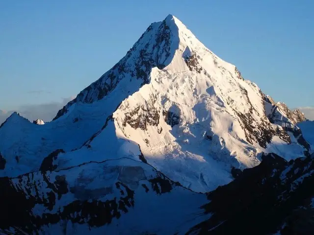 Seven magnificent and majestic snow-capped mountains within the territory of TibetThe Roof of the World—the Tibetan Plateau, is not only home to the world's highest peak but also boasts a series of famous mountain ranges. These mountains, like a backbone, set up the grandeur and vastness of the Tibetan Plateau, carrying people's hopes and blessings. 1, 🏔 Mount Everest (elevation 8848.86 meters) It is the main peak of the Himalayas and the highest mountain in China and the world. In Tibetan, 'Zhumu' means 'goddess,' and 'Langma' means 'mother elephant,' which together signify 'Mother of the Earth.' Mount Everest has a giant pyramid shape, standing tall and majestic, reaching into the sky. As the world's highest peak, it attracts countless gazes. Its grandeur is imposing, draped in a thin veil of snow, resembling a celestial maiden. 2, 🏔 Mount Kailash (elevation 6656 meters) It is the second highest peak of the Gangdise mountain range, with its snow-covered summit shining golden in the sunlight. Its pyramid-like shape is distinct from the surrounding peaks and is also considered a sacred mountain by devout followers. 3, 🏔 Mount Kula Kangri (elevation 7538 meters) Located in Lhozhag County in the Shannan region of Tibet, it is known as one of the 'Four Great Sacred Mountains' of central Tibet. The entire snow mountain is composed of three peaks. Standing alongside Mount Kula Kangri are six peaks over 7000 meters high. From a distance, the peaks stand shoulder to shoulder, resembling a towering ice and snow barrier that reaches the sky. 4, 🏔 Namcha Barwa (elevation 7782 meters) It is the highest mountain in Nyingchi, Tibet Autonomous Region. As the sacred site of Tibet's oldest Buddhist tradition, 'Yungdrung Bon,' it is known as the 'Father of Tibetan Mountains.' Its massive triangular peak is perennially snow-covered, shrouded in mist, and rarely reveals its true face, earning it the nickname 'Shy Girl Peak.' 5, 🏔 Shishapangma (elevation 8027 meters) It is an 8000-meter peak entirely within Chinese territory. In Tibetan, Shishapangma means 'the weather is extremely cold, and the climate is harsh and variable,' but the Tibetan people praise it as an 'auspicious sacred mountain.' Its north slope has a glacier valley over 10 kilometers long, with a forest of ice towers shining like a 'crystal garden.' However, it is also covered with crisscrossing ice and snow crevasses and occasional massive ice and snow avalanches, making climbing extremely difficult. 6, 🏔 Mount Sajama (elevation 6956 meters) Located in Yangxiu Township, Biru County, it has stood here for thousands of years, surrounded by mountains, with its main peak revered as the king of local sacred mountains. Its highest peak is 6556 meters, also known as 'Sapuganglaga,' and is one of the sacred mountains of the Bon religion in Tibetan Buddhism. 7, 🏔 Cho Oyu (elevation 8201 meters) It is the sixth highest peak in the world, located on the border between China and Nepal in the Himalayas. 'Cho Oyu' in Tibetan means 'the great master.' Cho Oyu stands tall and mighty in the Himalayas. Cho Oyu has five main ridges, and its mountain is perennially snow-covered, surrounded by snow peaks, with layers of mountains presenting a spectacular view. Let's appreciate the photos of the snow-capped mountains taken by friends who travel to Tibet! 🏔Luna_3_Winterthorn*52
 Mount Kailash | Experience the power of faith at the center of the worldMount Kailash, the center of the world🌍 It is the place of longing in the hearts of countless pilgrims and explorers Every year, thousands of believers make a pilgrimage around the mountain🏔, believing that walking around this sacred mountain can cleanse a lifetime of sins. Countless tourists are attracted by the mystery and sanctity of this mountain, and they go on a pilgrimage year after year The journey around the mountain is long and rugged, but it can't shake people's pursuit of faith Perhaps, walking alone in the mountains, in the wind and rain🌧, can truly feel the tranquility of the heart 📅The best travel season for Mount Kailash is from April to October 📅The best season for making a pilgrimage around the mountain is from May to June or from September to OctoberALISON NEAL
You Might Also Like
Lake Manasarovar
5.5
4.6/5145 Reviews
-US$0.69
From US$19.95
Nearby Attractions
Hanging Temple | Namu Na'ni Peak | Ancient city of Burang | Kejia Temple | Kega Temple | zhi re si | ma pang yong cuo shi di sen lin gong yuan | xi zao tang | Xianbolin Temple | zhu feng kong que bin jiang guang chang | Tuojia Temple | Jilong Bahe | Zhuoboqu | Yasepu | Cuojianggu | lang ri rong | long ba ri song | lin lin guo | qu duo ga ru tang ga | qia gui lang guo | xia ri long | jiang na long ba | gong zha ci ren pu | ma ni bai ma guo | na mu na ni feng | xiang bo lin si yi zhi | gu gong si | ma jia cang bu | pu lan xian la de si | ge ba tong ba
Popular Types of Attractions in Purang
Popular Restaurants in Purang
勇哥川菜館 | 正宗湖南湘菜館 | MA PANG YONG CUO | 灌江口家常菜大王 | 潤湖餐廳 | 銀城魚府 | 東北快餐小炒 | Dongbei Restaurant | 青海撒拉爾麵館 | 毛家湘菜館 | 簡陽羊肉湯石鍋雞 | 金滿堂飯莊 | 農家小炒 | 川香園 | 火記嘿小麪 | 慕辰豆花飯店 | 渝香餐館 | 重慶豆花城 | 成都餐館 | 四川家常菜飯店 | Shengchengmingchi | 拉薩朗傑林茶館分店 | 東北利民飯店 | |Sichuanlvdianfanguan | 豫皖砂鍋燴麵館 | 索南亞卓藏餐茶館 | 東北四海飯店 | 東北餃子 | 四川旅店飯店 | 東北餃子城
Recommended Attractions at Popular Destinations
Bangkok attraction near me | Manila attraction near me | Tokyo attraction near me | Taipei attraction near me | Hong Kong attraction near me | Seoul attraction near me | Los Angeles attraction near me | Kuala Lumpur attraction near me | Shanghai attraction near me | New York attraction near me | Shenzhen attraction near me | Osaka attraction near me | London attraction near me | Singapore attraction near me | Guangzhou attraction near me | San Francisco attraction near me | Beijing attraction near me | Macau attraction near me | Bali attraction near me | Paris attraction near me | Jakarta attraction near me | Ho Chi Minh City attraction near me | Orlando attraction near me | Phuket attraction near me | Toronto attraction near me | Chicago attraction near me | Cebu attraction near me | Seattle attraction near me | Istanbul attraction near me | Fukuoka attraction near me
Popular Ranked Lists
Popular Family-friendly Attractions Near Gangca | Top 20 Local Restaurants in Madrid | Top 20 Local Restaurants in Lisbon | Popular Family-friendly Attractions Near Jiaokou | Popular Family-friendly Attractions Near Shiquan | Top 9 Luxury Hotels in Washington D.C. | Top 20 Local Restaurants in New York | Popular Family-friendly Attractions Near Wanrong | Popular Luxury Hotels Near Skaftarhreppur | Top 18 Local Restaurants in Xishuangbanna | Top 21 Local Restaurants in Xiamen | Popular Family-friendly Attractions Near Longjing | Popular Luxury Hotels Near Asni | Top 19 Local Restaurants in Haikou | Popular Luxury Hotels Near Poipu | Top 17 Local Restaurants in Melbourne | Top 3 Premium Hotels in Binz | Popular Family-friendly Attractions Near Wuping | Popular Family-friendly Attractions Near Daqingshan County | Popular Family-friendly Attractions Near Arxan | Popular Local Restaurants in Hangzhou | Top 20 Local Restaurants in Zhengzhou | Top 3 Premium Hotels in Mersin Province | Popular Family-friendly Attractions Near Tianjun | Popular Family-friendly Attractions Near Leye | Top 20 Local Restaurants in Nara | Popular Family-friendly Attractions Near Bainang | Popular Luxury Hotels Near Gatlinburg | Popular Luxury Hotels Near Koh Lipe
Popular Trip Moments
Mount Kailash, the sacred mountain of the Tibetan Plateau | Mount Kailash Pilgrimage Guide, Personally Tested Effective Edition | Mount Kailash, an eternal snow-capped mountain, is a sacred place in the hearts of the Tibetan people | Welcome to Ali! To the west of Tibet, the essence of the Tibetan Plateau! | Lhasa-Shannan-Tingri-Ali-Shigatse trip | Lhasa-Shannan-Tingri-Ali-Shigatse trip | Mount Kailash in Tibet's Ngari Prefecture | Tibet Ali. | The most mysterious mountain in the world remains unclimbed to this day | Mount Kailash | Seven magnificent and majestic snow-capped mountains within the territory of Tibet | 2023-10-16 Sichuan Yunnan Tibet Xinjiang Gansu Qinghai | 2017-10-17 Sichuan Yunnan Tibet Xinjiang Gansu Qinghai Sichuan | Ancient architectural complex in northern Shanxi, Jinbei | Mount Kailash | Experience the power of faith at the center of the world | Only those who have been to Ali have been to Tibet|Ali North Line Strategy Sharing | The Potala Palace in Tibet | Mount Kailash||You should always go there and make a pilgrimage around the mountain at least once | Mount Kailash stands as a sacred mountain, a holy source for both Buddhism and Bon | The secret land of Western Tibet, Ali in the sky, Ali 2 | Mapang Yumco | Finally took a picture of the house by the "sea" | Tibet Ali, the journey of the sacred mountain and lake
More Things To Do in Purang
China eSIM Day Pass/data Package days selected without cards QR code | China Mainland eSIM|China Mobile Unlimited 4G High Speed Data | China·Hong Kong·Macau eSIM|Unlimited 4G High Speed Data | [China Mainland] eSIM | SIM to China | 8GB 8days 4G high speed | Global (66 Countries) eSIM Data Package (QR Code) | Asia・Australia eSIM|AIS SIM2Fly 8 days 6GB High-speed Unlimited 5G/4G Data | Mainland China eSIM |China Mobile 4G high-speed unlimited data eSIM | Mainland China + Hong Kong + Macau eSIM 4G Data Daily Plan QR Code | China Mainland + Macau 5G/4G eSIM QR Code by China Unicom | eSIM for China, Hong Kong and Macau. Universal for Mainland China/Hong Kong/Macau. Optional days for travel and business. QR code | Mainland China + Hong Kong + Macau eSIM Data Plan QR Code | China/Hong Kong/Macau eSIM 4G high-speed network QR code | Trip.SIM Japan, South Korea, Macau, Taiwan and many places in Asia + Australia and New Zealand 4G travel data roaming phone network card 4 days/7 days | Mainland China eSIM high-speed network QR code | China, Hong Kong, Macau 4G SIM Card (HK, Macau, Taiwan, China Delivery Only) | eSIM I series in multiple regions around the world | High-speed Traffic for tourism and business Internet access, unlimited Traffic, optional Days, QR code | eSender- Brunei/Indonesia/Singapore/Japan and many other countries and regions eSIM daily package/data package (QR code) | Global (30 Countries) eSIM Data Package (QR Code) | Hong Kong eSIM local - Data plan by Gohub (QR Code) | [China, Hong Kong and Macau] CMCC SmarTone CTM | 5G daily data Traffic| 24-hour billing | 3-30 days | Uninterrupted network support hotspot sharing | eSIM | Global multi-region B series eSIM|Universal in 54 countries Travel and business Internet access Optional unlimited data Optional days QR code | AIS SIM2Fly Global eSIM|15 days 6GB high-speed 4G/5G Unlimited Data | dtac GO INTER eSIM|Asia, Australia, USA 10Days 6GB Unlimited Data | Global eSim for 140+ countries (sent via email) by Xplori | AIS Asia eSIM data package (QR code) | Global multi-region A series eSIM|High-speed data, travel and business Internet access, optional unlimited data, optional days, QR code | Asia 9 Regions eSIM 4G Data Daily Plan QR Code | China, Macau eSIM - Data plan by Gohub (QR Code) | AIS Global eSIM data package (QR code) | 【5G SIM Card】China・National 5G Universal SIM Card |Total 10GB/15GB/30GB/45GB High-speed 5G Unlimited Data Service (Pick up at Shanghai Pudong T2)
Payment Methods
Our Partners
Copyright © 2024 Trip.com Travel Singapore Pte. Ltd. All rights reserved
Site Operator: Trip.com Travel Singapore Pte. Ltd.
Site Operator: Trip.com Travel Singapore Pte. Ltd.
The ticket was issued very quickly, the scenery of Gang Rinpoqi was very beautiful, we completed the mountain on foot 54 kilometers, very meaningful, the scenic service attitude is very good, the facilities are perfect, the recommended seat sightseeing car is a few kilometers away, very comfortable
The ticket was issued very quickly, the scenery of Gang Rinpoqi was very beautiful, we completed the mountain on foot 54 kilometers, very meaningful, the scenic service attitude is very good, the facilities are perfect, the recommended seat sightseeing car is a few kilometers away, very comfortable
Gang Rinpoche is the main peak of the Gangdise Mountains, one of the four major Tibetan Buddhist mountains (the other three are the Meili Snow Mountain, Animaqing Mountain, and the Dojowo), known as the center of the world. Mapangyucuo is one of the three holy lakes (the other two are Namcuo and Yangzhuoyucuo), located south of Gangrenpoqi, echoing the Shenshan Mountain. Laangyu, known as Ghost Lake, is separated from Mapangyucuo all the way, Mapangyucuo is a freshwater lake, Laangyucuo is a saltwater lake, and people and animals can not drink. Namnani Peak is located in the western Himalayas, across the holy lake from Gang Rinpoche.
Very hard, but also very shocking, 8:30 in the morning to the scenic spot, to the Zhire Temple to end the first day of the trip, tired, but it is worth it, it is a practice for yourself, continue the trip the next day
Going to Gang Rinpoche to the mountain for two days is very challenging! The wish was finally achieved and walked 56 kilometers in two days.
Well worth a visit.
Very nice trip
No regrets in this life.