


1 / 16
Mentioned in This Moment
4.7/5121 reviews | Natural scenery
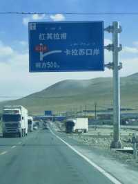
Akto
View
Show More
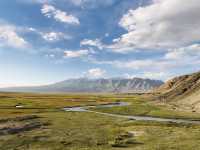
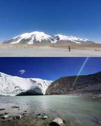
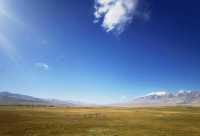
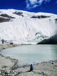
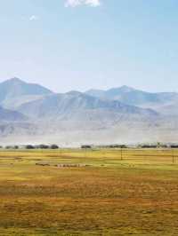
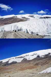
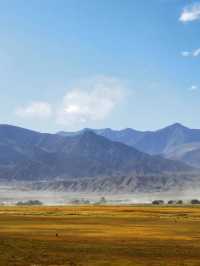
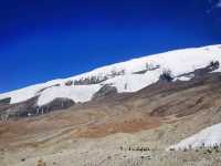
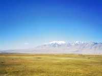
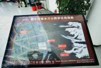
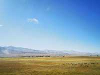
Popular Trip Moments
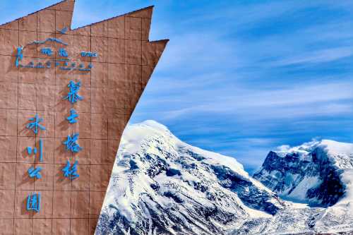
Xinjiang Baisha Lake - The Pearl of the Secret Realm [Recommended 10-Day Tour in Southern Xinjiang] | Citywalk: Kashgar and the Pamir Mountains, Xinjiang - Explore the Beauty of the Borderlands | New Year's Holiday Urumqi-Korla 8-Day Itinerary Must-Read Guide | Kashgar–Tashkurgan 2-Day Tour in Xinjiang: A Super Detailed Guide! Save Now! | Planning a trip to Kashgar, Southern Xinjiang for the long weekend? Check out our travel guide! | Muztagh Glacier Park is located in Tashkurgan Tajik Autonomous County, Kashgar Prefecture, Xinjiang | Celebrate New Year in Urumqi and Kashgar, Xinjiang - breathtaking beauty | Kashgar-Kizilsu 3-Day Tour: A Must-See! | 6-Day Itinerary for Kashgar, Southern Xinjiang: Must-See Attractions | Exotic Xinjiang trip | 2-Day Tour of Kashgar and the Pamir Plateau: Don't Miss the Stunning Plateau Scenery! | What are the travel safety tips for Baisha Mountain and Baisha Lake Scenic Area? | No. 4 Glacier | Majestic as an epic, crystal clear as new snow | China-Pakistan Friendship Highway: An Adventurer's Paradise | Muji Crater, the Eye of Pamir | Baisha Lake | The beauty of Xinjiang's White Sand Lake needs no filter. | Karakul Lake║A blue lake under the Muztagh Glacier. | The "Eye of the Devil" on the Pamir Plateau - the Muji Crater. | The White Sand Lake Scenic Area is great value! | 2-Day Tour of Kashgar, Southern Xinjiang: A Must-See Guide! | Explore Southern Xinjiang | Kashgar Citywalk, Take the Road Less Traveled. | Southern Xinjiang - Tashkurgan Citywalk: A Stroll with Old Friends. | 10-day cross-Xinjiang itinerary, including Urumqi and other must-see places. | Explore the mysterious Pamir Plateau. | 10-Day Tour of Urumqi, Xinjiang and More: Don't Miss Out! | Ke County Glacier Park | Karakul Lake | I prefer this secluded town deep in the snow-capped mountains of Kashgar to Altay. | Anniversary trip to Xinjiang
Popular Travel Types
Recommended Attractions at Popular Destinations
Bangkok attraction near me | Manila attraction near me | Tokyo attraction near me | Taipei attraction near me | Hong Kong attraction near me | Seoul attraction near me | Kuala Lumpur attraction near me | Los Angeles attraction near me | Shanghai attraction near me | New York attraction near me | Shenzhen attraction near me | Osaka attraction near me | Singapore attraction near me | London attraction near me | Guangzhou attraction near me | San Francisco attraction near me | Beijing attraction near me | Macau attraction near me | Bali attraction near me | Jakarta attraction near me | Paris attraction near me | Ho Chi Minh City attraction near me | Istanbul attraction near me | Phuket attraction near me | Chicago attraction near me | Seattle attraction near me | Toronto attraction near me | Orlando attraction near me | Cebu attraction near me | Chiang Mai attraction near me
Popular Attractions
Bipenggou | SivarLand | Siberia Tiger Park | Ba Na Hills | Ho Chi Minh's Mausoleum | Window of the World | Canterbury Museum | Jiangnan Tianchi Resort | Golden Dome Cabaret Show | Humble Administrator's Garden (Zhuozheng Garden) | Manly Beach | Dreamworld | SEA LIFE Bangkok Ocean World | Chao Phraya River | Andamanda Phuket Waterpark | Glacier Southern Lakes Helicopters | Surigao City Boulevard | Ping'anqiao Catholic Church | The White Dragon Pond of Miyun | Bücherei Goddelau | ADDOTOUR229 | Upper Whitefish Lake | AKVA TERA | Al Fath Al Maged Mosque | LaGoshen MB Church | Edgebrook Branch, Chicago Public Library | Camp Smith Trailhead II | Foundation Christian Church | Roman Catholic Diocese of Terni-Narni-Amelia | The Treasure Gallery
Popular Restaurants in Akto
冰山餐廳 | 愛帕度假酒店(白沙湖店)·愛帕雲端氂牛火鍋店 | 紅山口郵政餐廳 | 金絲路文化旅遊餐廳 | 夜尚休閑吧 | 塔莎飯店 | XIANG QU ER DAN GAO XI BING WU A KE TAO DIAN | 邁德堡清真漢堡 | 貝克漢堡 | 阿克陶縣克依木快餐店 | 海洋美食 | 白沙湖冷水魚餐廳 | A JI MU NIU ROU MIAN GUAN | 帕米爾高原餐廳 | 西北肥牛 | 月圓餐廳 | 小晴天 | 嫂子麪館 | 喬格丹快餐 | 花園涼皮店 | 關東餐廳 | 烏市穆薩大盤雞店 | 蓋孜古道驛站餐廳 | 慕士塔格快餐廳 | 四川飯店 | 寧夏瑪麗婭 | Rehemaititewei'er Fast Food | 珠拉美食 | 阿克陶縣布隆口快餐店
Popular Ranked Lists
Popular Local Restaurants in Yantai | Top 19 Local Restaurants in Los Angeles | Top 11 Best Things to Do in Krabi | Top 6 Best Things to Do in Huaihua | Popular Local Restaurants in Macau | Popular Luxury Hotels Near Turkler | Top 15 Local Restaurants in Taipei | Popular Best Things to Do in Ningming | Top 4 Best Things to Do in Shaoguan | Top 5 Best Things to Do in Daxing'anling | Popular Premium Hotels in Stirling | Top 5 Best Things to Do in Hinggan League | Top 7 Luxury Hotels in Zurich | Top 7 Best Things to Do in Phi Phi Islands | Popular Premium Hotels in Remah | Top 4 Best Things to Do in The Rocks | Popular Premium Hotels Near Columbus | Top 3 Best Things to Do in Heihe | Top 9 Local Restaurants in Malé | Popular Local Restaurants in Suzhou | Top 19 Local Restaurants in Budapest | Popular Luxury Hotels Near Sadikbey | Popular Luxury Hotels Near Nesselwang | Popular Best Things to Do in Zhumadian | Top 4 Best Things to Do in Jiangshan | Top 8 Best Things to Do in Ji'an | Popular Premium Hotels Near Tomsk | Popular Best Things to Do in Qianwei County | Popular Local Restaurants in Hefei | Popular Best Things to Do in Daocheng
Payment Methods
Our Partners
Copyright © 2025 Trip.com Travel Singapore Pte. Ltd. All rights reserved
Site Operator: Trip.com Travel Singapore Pte. Ltd.
Site Operator: Trip.com Travel Singapore Pte. Ltd.