
Things to do in Qamdo
Explore top experiences
Top 10 attractions in Qamdo


Ranwu Lake
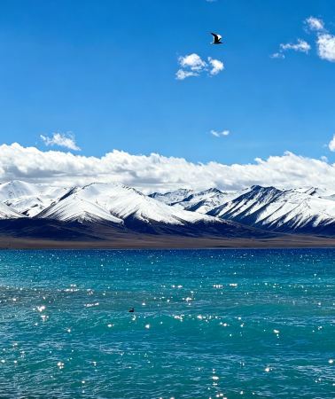
Ranwu Lake is a barrier lake in the headwaters of the Parlung Zangbo River, a tributary of the Yarlung Zangbo River, formed by landslides and debris flows blocking the river channel. The lake sits at an altitude of over 3,800m, and the narrow lake body stretches for over 20 km, consisting of three connected lakes—Yangcuo, Bangcuo, and Leng'anjia Bu—forming a chain. It is no more than 1–2 km wide at its widest point, resembling a string of pearls laid beneath the snow-capped mountains. Its end is adjacent to the Laigu Glacier group, and glacial meltwater continuously flows into the lake, providing a constant supply. The lakeshore is covered with vast meadows, the pebble beaches along the shore are colorful, and white waterfowl can often be seen swimming in the shallows. Each season here has its own highlights: in spring, tree shadows sway on the lake surface; in summer, the meadows turn green; in autumn, the forests are dyed golden; in winter, mist fills the air and snow-capped peaks stretch endlessly, and the lake water also shifts between azure blue and greenish-blue depending on the season and lighting.Basu · 69.2km from downtown

Laigu Glacier
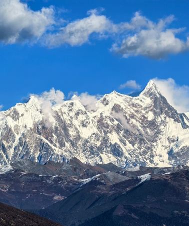
Many glaciers surrounding Laigu Village have formed many ice lakes in front of the village. Due to the different geology and soil composition of different glaciers, each ice lake will reflect different colors. There is a large ice lake floating on the ice lake. Big and small icebergs. Between the end of the glacier and the glacial lake, the broken glacier reveals a layer of blue ice tens of meters high. In Laigu Village, you can see Meixi Glacier, Yalong Glacier, Ruojiao Glacier, Dongga Glacier, Xiongjia Glacier and Niuma Glacier. Because all these glaciers surround Laigu Village, they are collectively called Laigu Glaciers ( Note: Due to the changing seasons of glaciers, the viewing period of each glacier is different, and the scenery seen at different times is different.) Among them, the Yalong Glacier, which is 12 kilometers long at the eastern end of Gangrigabu Mountain, is more majestic. It is more than 6,000 meters above sea level. The main peak extends to the edge of Laigu Village at an altitude of about 4,000 meters. The simple village road along the Ranwu Lake, even if you have reached the ancient village, the Laigu Village with more than 70 households still maintains the original Tibetan village style of half farming and half pastoralism. The houses in the village are relatively scattered, subdivided into several smaller villages and settlements such as Shatuna, Lanage, Qu'e, and Ranmu. The distance between the villages is two to three kilometers, and there are fields between the small villages. ridge.Basu · 86km from downtown

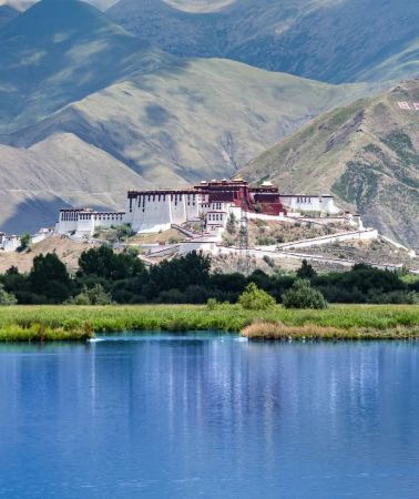
Zizhu Temple
"Zizhu" is a literal translation of Tibetan pronunciation, meaning the top of six mountains, and religiously symbolizes the sixth degree of Paramita. It is said that the Zizhu Temple was founded by the Tibetan king Muchizanpo. In the era of the living Buddha Luodan Nyinpo, the Zizhu Temple was expanded once, and the scriptures were engraved and the Buddha statues were shaped, and the Zizhu Temple began to take shape. Entering the era of Lama Gawanglanga, the monastery's esoteric and esoteric study system was further standardized and institutionalized. Under the hard work of the living Buddhas and masters of the Zizhu Temple in the past dynasties, the Zizhu Temple had an important impact on the later religious development in Qamdo in terms of building scale, number of monks, system of learning scriptures and style of dancing gods. Especially after Buddhism dominated most of Tibetan areas, Bon religion survived in the area centered on Zizhu Temple, which made Zizhu Temple enjoy a high reputation among Bon temples. Until now, most of the residents in this area still believe in Bon religion, and Zizhu Temple has also become a special holy place for Bon culture.Dengqen · 31.6km from downtown

Zig-Zag Mountain Road With 72 Turns
The 72nd turn of the Nujiang River is located in the Basu County in the Qamdo region, and is located between the Changdu Bangda and Basu on the southern Sichuan-Tibet line, also known as "the 99th turn of the Sichuan-Tibet". The 72nd turn of the Nujiang River is not a scenic spot, but almost all passers-by will stop for a while and enjoy the surrounding mountains when they reach the commanding heights of the road. The Nujiang River 72 turns westward from Bangda, climbs Yela Mountain with an altitude of about 4,658 meters, and then circles down to the Nujiang Canyon with an altitude of about 3,100 meters. The relative height difference is nearly 1,500 meters, and the winding road is about 12 kilometers. As the only way to go through the south Sichuan-Tibet line, the road is narrow and the slope is steep. For many riders or riders, it is precisely because of its danger that it is more challenging. Pedestrians passing by this road every year are full of sigh.Basu · 37km from downtown

Yanjing Ancient Salt Fields
The ancient salt fields have a long history, dating back more than 1,300 years. There are more than 3,200 salt fields built on the beaches and steep cliffs on the east and west banks of the Lancang River, with an annual salt production of millions of kilograms. Here you can watch the whole process of handmade salt making, as well as the unique and primitive production tools, hardworking and simple salt farmers and simple folk customs. The China Tea Horse Road Tibet Salt Well History and Culture Exhibition Hall is an earlier exhibition hall on the history of the Ancient Tea Horse Road in China; the Quzika Hot Spring Group has a total of 108 hot springs, known as "Hundred Springs Reflecting the Moon", with water temperatures ranging from 25 degrees to 80 degrees, containing more than 20 kinds of minerals, which is the best among hot springs and a natural sanatorium.Markam · 70.5km from downtown

Three-Color Lake
"Three-Color Lakes" consist of Black Lake, White Lake, and Yellow Lake, each displaying different colors under sunlight. The lakes are arranged in an irregular "Pin" character shape, separated by low mountain platforms, and formed by years of accumulated ice and snow in the low-lying valleys.Banbar · 24km from downtown

Xianggela Glacier
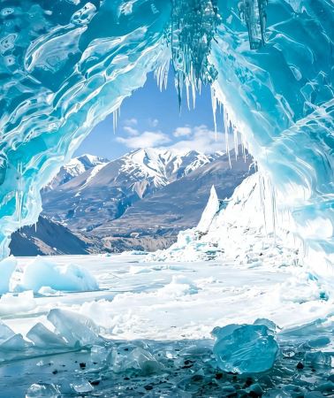
Deep in the Nyainqêntanglha Mountains in Bianba County, Changdu City, lies the Xianggela Glacier. It serves as the main water source for a tributary of the upper Nu River and is located adjacent to the Three-Color Lake scenic area. Stretching from the summit of the snow mountain to the glacial lake, this "ice dragon" is approx. 9 km long and truly magnificent. The white floating ice and towering snow peaks complement each other; especially in winter, when the lake freezes, the broken ice refracts a deep blue light under the sun, resembling scattered sapphires. For local residents, this icy blue expanse is considered a sacred place, carrying unique beliefs and culture. Thanks to the convenience of being accessible by car, this undeveloped and secluded realm is attracting an increasing number of travelers seeking pristine scenery to witness the purity of this land.Banbar · 28.9km from downtown

Qiangbalin Temple
Qiangbalin Temple is located on the fourth-level platform in Qamdo Town. The main Buddha in the temple is Qiangba (Daci) Buddha, so the temple is named Qamdo Qiangbalin Temple. The monastery has more than 5,000 monks for a long time, and there are 70 small monasteries around it. It is the largest monastery in Kham. The main buildings of the temple are well preserved. There are hundreds of statues of Buddhas and eminent monks, thousands of square meters of murals and many Thangka paintings in the scripture hall. Legend has it that the Gelugpa master Tsongkhapa, when he was 16 years old, was on his way to study the scriptures, and when he passed by the beautiful place where the two waters meet, he predicted that this would be the place to promote the Dharma. When the temple was built, Xirao Sangbu went to a thousand households to teach sutras for alms, and the thousand households dedicated their pastures as the site of the temple. It is said that the current location of Sangdui Zhacang, one of the five major Zhacangs in the temple, is the place where thousands of households set up yak tents.Qamdo · 974m from downtown

Dongda Mountain
Dongda Mountain, a high mountain pass on the Sichuan-Tibet Highway, is also known as the "forbidden zone of life". There is snow all year round. It is 5,008 meters above sea level. On one side of the mountain is the surging Lancang River, and on the other side is Zuogong. In Dongda Mountain, the temperature on the Bangda grassland can reach below zero degrees Celsius. However, the temperature on the banks of the Lancang River and the Nujiang River is around 20 degrees Celsius. The altitude difference experienced in a day can be nearly 2,500 meters. Between the two counties are Jueba Mountain, Lawu Mountain and Dongda Mountain with an altitude of nearly 6,000 meters. The road conditions are not very good, and there is often a feeling of "people and horses falling down".Markam · 55.7km from downtown

Rawu Town
Rawu Town is a town under the jurisdiction of Baxoi County, Qamdo City, Tibet Autonomous Region, and administers 12 village committees:Waba Village,Ranwu Village, Ranna Village, Zhongba Village, Kangsha Village, Laigu Village, Kadui Village, Maiba Village, Yaka Village, Ari Village, Yaze Village, and Daba Village. It is located in the western part of Baxoi County, Qamdo City, Tibet Autonomous Region, approx. 90 km from the county seat. Major tourist attractions include Ranwu Lake, Laigu Glacier, andDemla Mountain Passon the Rancha Highway. Ranwu Lake is a beautiful sight in Ranwu, a plateau lake nestled among high mountains, with an elevation of over 3,800m. It is located approx. 89 km southwest of the Baxoi county seat, and the Sichuan-Tibet Highway passes by its shore. It is the source of theParlung Tsangpo River, and the climate here is humid and rainy in summer. Ranwu Lake provides a clean and abundant water source for Rawu Town. There are grasslands and farmland by the lake, and in the distance, you can see rolling snow-capped peaks and ancient sand willows that have grown naturally for thousands of years. It is well worth staying for a few days. From Ranwu, it only takes 1 km to reach the edge of Ranwu Lake after turning onto the Rancha Highway. There are snow-capped peaks by the lake, and the scenery is beautiful.Basu · 63.3km from downtown
Experiences you can't miss in Qamdo
Featured Travel photography in Qamdo
View all Travel photography![Bome travel photo shoot[Family Portraits, Parent-Child Photos, Wedding Photography, Aerial Shots, Street Photography, Candid Shots, Photo Sessions, Wedding & Portrait Photography, Videography, Translation Services]](https://ak-d.tripcdn.com/images/0352012000o3mzc3iB2B9_C_568_320.jpg?_fr=wc)
![Qamdo Trip Moments[Family Portraits, Parent-Child Photos, Wedding Photography, Aerial Shots, Street Photography, Candid Shots, Photo Sessions, Wedding & Portrait Photography, Videography, Translation Services]](https://ak-d.tripcdn.com/images/0351s12000o809tlo02E3_C_568_320.jpg?_fr=wc)
![Dengqen Trip Moments[Photography Services: Follow Shoots, Aerial Photography, Scheduled Sessions, Candid Shots, Street Photography, Portraits, Wedding Photography, Short Films/Multilingual Translation/All Original Photos Included]](https://ak-d.tripcdn.com/images/0350z12000pvq07m7BD5D_C_568_320.jpg?_fr=wc)
![Zhag'yab Travel Photography[Enda Hot Spring Waterfall photography and aerial videography + multilingual local photographer]](https://ak-d.tripcdn.com/images/0355g12000o6l9t5nA672_C_568_320.jpg?_fr=wc)
Instant confirmation
Book now for today
FromNZD 60.21
![Trip Moments in Zogang County[Promotional videos, microfilms, documentaries/wedding photography activity shooting/commercial photography and videography/all raw footage included]](https://ak-d.tripcdn.com/images/0350j12000qdwxfd470D7_C_568_320.jpg?_fr=wc)
FromNZD 722.46
![Gonjo Trip Moments[Microfilm promotional videos/documentaries/commercial photography & videography/personal portraits/multilingual translation]](https://ak-d.tripcdn.com/images/0351j12000r61al5o9CC6_C_568_320.jpg?_fr=wc)
Instant confirmation
Book now for today
FromNZD 301.03
![Lhorong trip moments[On-site photography and videography services including family-friendly and couple photos, short videos, promotional videos, portraits, wedding photos with all raw images provided]](https://ak-d.tripcdn.com/images/0354b12000s586x9a4771_C_568_320.jpg?_fr=wc)
FromNZD 361.23
![Trip moments in Markam[Photography and videography services including family-friendly, individual and couple photos, short videos, promotional videos, portraits, wedding photos with all raw images provided]](https://ak-d.tripcdn.com/images/0355j12000s5mpwqwCC1D_C_568_320.jpg?_fr=wc)
FromNZD 361.23
Featured SIM card in Qamdo
View all SIM card
4.6/5
· 69.2k reviews· 2mil bookedFree cancellation
Book now for today
Fast-selling Wi-Fi & SIM cards
50% off
Limited-time sale
FromNZD 0.16NZD 0.32

4.6/5
· 23.5k reviews· 656k bookedFree cancellation
Book now for today
91.5% of travelers recommend
50% off
Limited-time sale
FromNZD 0.16NZD 0.32

4.6/5
· 9.5k reviews· 224.9k bookedFree cancellation
Book now for today
Similar travellers pick
50% off
Limited-time sale
FromNZD 0.15NZD 0.3

4.6/5
· 31.4k reviews· 928.2k bookedFree cancellation
Book now for today
Fast-selling Wi-Fi & SIM cards
50% off
Limited-time sale
FromNZD 0.16NZD 0.32

4.6/5
· 6.4k reviews· 184.9k bookedFree cancellation
Book now for today
Fast-selling Wi-Fi & SIM cards
51% off
Limited-time sale
FromNZD 0.14NZD 0.29

4.6/5
· 9k reviews· 233.4k bookedFree cancellation
Book now for today
Similar travellers pick
51% off
Limited-time sale
FromNZD 0.14NZD 0.29

4.6/5
· 2.3k reviews· 56.3k bookedFree cancellation
Book now for today
90.9% of travelers recommend
51% off
Limited-time sale
FromNZD 0.14NZD 0.29

4.6/5
· 6.7k reviews· 172.8k bookedFree cancellation
Book now for today
91.7% of travelers recommend
50% off
Limited-time sale
FromNZD 0.15NZD 0.3
Free things to do in Qamdo
Ranwu Lake
Basu · 69.2km from downtownLaigu Glacier
Basu · 86km from downtownZizhu Temple
Dengqen · 31.6km from downtownZig-Zag Mountain Road With 72 Turns
Basu · 37km from downtownYanjing Ancient Salt Fields
Markam · 70.5km from downtownThree-Color Lake
Banbar · 24km from downtownXianggela Glacier
Banbar · 28.9km from downtownQiangbalin Temple
Qamdo · 974m from downtownDongda Mountain
Markam · 55.7km from downtownRawu Town
Basu · 63.3km from downtown
More ways to travel from Qamdo
Private Tours in Qamdo
View More Private Tours in Qamdo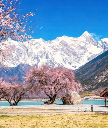


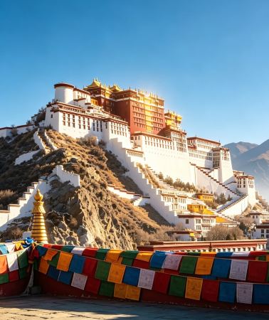
Group Tours in Qamdo
View More Group Tours in Qamdo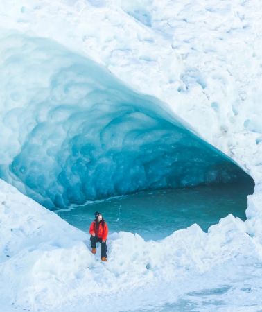
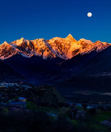
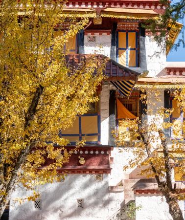

What travellers say about Qamdo

tokiiii1 July 2025
5.0
Tibet! I would like to do it thousands of times!
To see the most beautiful scenery of Ranwu Lake, you must go there in early spring in Tibet, around mid-to-late April, when the frozen lake surface has just melted, the azure blue water is exposed above the ice, and the snow-capped mountains are reflected in the water. After seeing it, you can't help but sigh: It's so beautiful!
Ranwu Lake

M49***489 October 2025
5.0
Laigu Glacier, one of the world's three largest glaciers, is located in Ranwu Town, Basu County, Qamdo Prefecture, Tibet. It offers a glimpse into a dreamlike wonderland of 10,000-year-old blue ice. The crystal-clear ice, snow-capped mountains, and glacial lakes create a breathtaking spectacle, akin to stepping back into the Ice Age and experiencing the power of nature. The best viewing period is from December to February, when the ice is solid and at its largest. At an altitude of approximately 4,200 meters, be prepared for cold and altitude sickness, and crampons are recommended for safe trekking.
Laigu Glacier

猜猜狼25 October 2025
4.0
The path is quite difficult to walk, but there are a lot of tourists, so it is definitely worth a visit. Let me say something different. Can the restrooms be cleaned up? The women's restroom is impossible to enter, and the floor is covered in feces. It's disgusting.
Zizhu Temple

倩ang🍓🍉🍑🍒25 August 2025
5.0
The 72 bends of the Nujiang River are a "road miracle" deep within the Hengduan Mountains. In just 12 kilometers, the altitude plummets 1,500 meters, and the 72 bends wind through the mountains like a silver chain, each one a breathtaking spectacle.
Driving along this route, you'll sometimes plummet to the valley floor, watching the Nujiang River surge like emerald jade; sometimes, you'll circle the mountaintops, gazing at a sea of clouds over snow-capped peaks. On clear days, sunlight slices through the mist, casting a shimmering shadow over the bends. On rainy days, clouds and mist stream past the car windows, and the wheels roll over not only the road but also the vastness of the world.
This is a testing ground for the brave and a collector of beautiful scenery. Every turn is a soulful encounter with snow-capped mountains, canyons, and rivers, making every second of the drive a breathtaking experience etched into the memory.
Zig-Zag Mountain Road With 72 Turns

M85***979 April 2025
5.0
The Millennium Ancient Salt Fields of Yanjing are located in the Naxi Ethnic Township of Mangkang County, Changdu City, Tibet. In the unique landforms along the Lancang River, it is a cultural wonder that continues the ancient salt-making tradition of more than 1,300 years. The following is a brief review and travel tips:
Core Highlights
Living Fossil of Millennium Salt-making Technology
The salt fields still use the "sunlight salt drying method" circulated in the Tang Dynasty: locals use wooden frames to build salt pools, and guide the Lancang River brine to evaporate and crystallize naturally, forming red and white salt (red salt is produced in Jiangdong, and white salt is produced in Jiangxi). This wisdom of symbiosis with the natural environment has been listed as a national intangible cultural heritage.
Spectacular Cascading Salt Field Landscape
Thousands of salt fields are scattered along the river, reflecting the sky like a mirror. Especially in the early morning or at sunset, the salt fields, the Lancang River Canyon, and the snow-capped mountains in the distance form a very visually impactful picture, which photography enthusiasts should not miss.
Multicultural fusion in eastern Tibet
Yanjing is an important node on the ancient Tea-Horse Road. Tibetans and Naxi people live together here. You can also see the only Catholic church in Tibet (built by French missionaries in the 19th century), forming a unique fusion of beliefs and cultures.
Travel experience suggestions
Watch the salt workers work: In the early morning, you can see villagers carrying brine and collecting salt, and experience the magical process of "salt being born from the river water".
Taste special food: The local salt field red salt pickled in Laoyanjing Jiajia noodles (with Tibetan pork) and Yanjing wine have a unique flavor.
Visit the ancient village: The surrounding Tibetan watchtowers, Catholic churches, and Yantian Museum are worth visiting to experience the collision of multiple cultures.
Precautions
Transportation: It is recommended to drive or charter a car (about 2 hours from Mangkang County to Yanjing). Some sections are rugged and need to be cautious in the rainy season.
Altitude adaptation: Yanjing is about 2,300 meters above sea level, which is milder than other areas in Tibet, but you still need to pay attention to altitude sickness.
Best season: March-May (peak season for salt drying, pleasant climate) or September-November (autumn colors against the salt pans), avoid the rainy season from July to August.
Respect customs: Please communicate before photographing the salt workers to avoid interfering with their work; keep the church and the village quiet.
Summary
The ancient salt pans of Yanjing are not only a visual wonder, but also a civilized witness of the coexistence of man and nature. This place is suitable for travelers who pursue a deep cultural experience, and feel the thousand-year salt rhyme frozen in time in the quiet Lancang River Canyon.
Yanjing Ancient Salt Fields

打你还轻11 October 2024
5.0
The three-color lakes are arranged in the shape of a Chinese character "品", namely Black Lake, White Lake, and Yellow Lake. The surface of the Black Lake is covered by the shadow of the mountain, and the black rock mountain body directly immerses the bottom of the lake. The water is deep and dark, so it is named "Black Lake". The White Lake is named because the sand and stones on the lake beach are white. The lake water is clear and blue, like a bright sapphire. The Yellow Lake is a dead water lake, which is a lake alone. It has the smallest area and the lake water is turbid and rich in yellow minerals.
The scenery around the three-color lake is magnificent, surrounded by snow-capped mountains, lush meadows, dense forests, and rare wild animals and plants. This place not only shows the magic of nature, but also carries rich ecological and cultural values.
The three-color lake has a unique charm in all seasons, but relatively speaking, May to September is a more suitable season for playing.
1. Prevention of altitude sickness: The area where the three-color lake is located is at a high altitude. Understand your physical condition in advance, take anti-altitude sickness drugs in advance, pay attention to rest when you first arrive at the plateau, and avoid strenuous exercise.
2. Changeable climate: Bring enough warm clothes, including jackets, down jackets, etc., to prevent sudden cooling or bad weather.
3. Sun protection measures: Ultraviolet rays are strong in plateau areas, so bring sunscreen, sunglasses, sun hats and other sun protection products.
4. Itinerary planning: Plan your itinerary in advance and understand the local traffic conditions and distribution of scenic spots.
5. Respect local culture: Respect local religious beliefs and customs to avoid unnecessary troubles caused by cultural differences.
6. Environmental awareness: Carry garbage bags with you, do not throw away garbage at will, and protect the natural environment.
7. Food and water: Prepare sufficient drinking water and easy-to-store food to prevent inconvenience in local purchases.
8. Communication equipment: The signal may be weak in some areas, so take countermeasures in advance and inform relatives and friends of the itinerary arrangements.
9. Medical preparations: Bring some common medicines, such as cold medicine, anti-inflammatory medicine, gastrointestinal medicine, etc., to deal with possible physical discomfort.
10. Complete documents: Bring your ID card and other relevant documents for inspection.
Three-Color Lake

亦言亦行14 June 2024
4.0
The three-color lake is unremarkable, but the glacier eight kilometers ahead is refreshing. No matter the size of the glacier, the color of the ice lake, or the clear blue ice, it is not inferior to the glaciers I have seen elsewhere. The best thing is that few people know about it, and we have this treasured landscape all to ourselves.
Xianggela Glacier

非凡轶生5 September 2023
5.0
Qamdo Jampa Ling Monastery, also known as "Qamdo Monastery", is a Tibetan Buddhist Gelugpa monastery located in Chengguan Town (also known as "Qamdo Town"), Qamdo County, Qamdo Prefecture, Tibet Autonomous Region, China. It is the largest monastery in Kham and is known as the "First Zen Forest in Eastern Tibet". The monastery was founded by Tsongkhapa's disciple Xirab Songbu in 1444. The main Buddha in the monastery is Jampa (Great Compassion) Buddha, so the monastery was named Qamdo Jampa Ling Monastery. The main buildings of the monastery are well preserved. There are hundreds of various Buddha statues and statues of eminent monks in the scripture hall, thousands of square meters of murals and numerous thangka paintings. It can be said that it has brought together the wisdom and talents of Qamdo craftsmen and represents the highest level in the Qamdo area.
Qiangbalin Temple

善良牛16 September 2021
5.0
The most beautiful scenery is on the 318 road.
Started from Batang at 7 am and arrived in Basu at 7 pm.
Passed Dongda Mountain with an altitude of 5,100 meters along the way.
Crossing the 72 bends of Nujiang River.
Every self-driving trip is a different experience.
Let's have a pot of mushroom soup to replenish our body and go to eat.
Dongda Mountain

M31***5423 June 2020
5.0
Ranwu, a place you must have fun in Tibet, a place that must be highly recommended
[Scenery] 👿👿👿👿👿👿👿👿👿👿👿👿👿👿👿👿👿👿👿👿👿 Paradise on earth
Rawu Town


